Documenting lessons learned

Over the last several weeks, I have been reminded often of Thomas King’s closing statements from his 2003 Massey Lectures, The Truth About Stories.

To paraphrase, each lecture was ended by stating you could take the story told during the lecture and do what you wanted with it — forget it, retell it, learn from it — but you could not go through life saying you would have done things differently, if only you had heard that story.

Archaeology in British Columbia is not a straightforward story and by recognizing and respecting the value of Indigenous knowledge, archaeologists can do a better job representing the archaeology of British Columbia.

Archaeologists working in cultural resource management have worked with Indigenous communities for many years — and this working relationship has changed over time.

At the start of my career in the late 1990s, the relationships between archaeologists and Indigenous communities were most often extractive, rather than collaborative.

The development of field methods, as well as the analysis and interpretation of findings, were done by archaeologists with little input from Indigenous communities (not all, but it’s safe to say this was the normal way of doing things).

We made decisions (and still do) about where to look for archaeological sites based on measurable and quantitative characteristics, such as landforms, proximity to water and availability of resources, but often missed the opportunity to gain insight from Indigenous knowledge keepers regarding land use (for example) and where they think we should be looking for archaeological sites.

Over the last couple of years, nearly half of the work I’ve done is for First Nations or First Nations-owned businesses.

This isn’t new, and many of my colleagues have worked directly for First Nations for decades, but it has become more commonplace throughout our industry.

Forest licensees or other developers hire a First Nation or First Nation-owned company to conduct archaeological assessments and the nation will either conduct the assessments with staff archaeologists or contract an archaeologist to provide technical support.

In either scenario, it is the nation that has control over field methods, data collection and reports.

The quality of archaeological assessments and the interpretations of findings improve with Indigenous knowledge and nations control their own cultural heritage.

The starting place for forming relationships within which we can do better work, make better interpretations and more accurately represent the pre-contact way of life in British Columbia does not need to be complicated.

One of the best lessons I received in how to begin these relationships came from my son, who was five years old at the time, at an annual gathering between First Nations and industry in Northern B.C.

The intention of the gathering was to introduce industry and First Nations on the traditional territory to discuss working relationships and meaningful collaboration.

I offered a lithic workshop at the gathering, which was most often a group of children in oversized gloves and safety glasses bashing rocks and making rough stone tools.

While setting up the workshop one year, my son grew bored and asked if he could play with a group of kids running around nearby.

It didn’t occur to him that there were any differences between himself and the other kids and he walked up and introduced himself.

“Hi, my name is Sam, can I play with you?”

There was no hesitation and off they all ran together. Here we were, at an organized event with an agenda, intentions, and ambition, but a group of kids showed us a starting place.

I have had the privilege of working with many Indigenous communities throughout B.C. I have been reminded I have a lot to learn, provided I open my ears and shut my mouth (excellent words of advice).

However, since watching my son run up to that group of kids, whether I’ve used those exact words or tried to sound smarter, I always think to myself: “Hi, my name is Matt, can I play [work and learn] from you?”

It’s simplistic, but I can’t think of a better place to start a discussion.

Matt Begg is a Kamloops-based archaeologist.

How DNA can be used to answer questions about ancestry

The recent findings at the Kamloops Indian Residential School have prompted many questions. There have been questions about what archaeology, and specifically forensic science, can do to assist with supporting the work that may lie ahead. As Kukpi7 Rosanne Casimir wrote in the June 10th Full Chief and Council Update on the Kamloops Indian Residential School letter, “ Tk’emlúps te Secwépemc Chief and Council have met internally and will continue to do so, to plan, organize and determine the best way forward.” The update also indicated agathering of forensic archaeologist experts” (https://tkemlups.ca/wp-content/uploads/061021-Jun10-KIRS-update.pdf). One of the tools that forensic archaeologist could utilize is deoxyribonucleic acid, commonly known as DNA. This is not to say that DNA studies will be completed, but it is one tool that has been used by forensic experts to connect individuals to family members. However, DNA studies are not without some complications and may not always provide a clear result.   

DNA is a complex molecule that contains all of the information to build and maintain an organism. All living things have DNA within their cells and it is the primary unit of heredity in organisms of all types. What this means is that when an organism reproduces, a portion of their DNA is passed along to their offspring. Once DNA is extracted from a sample in the laboratory setting, work begins to track ancestry. Paternal ancestry is seen by looking at the Y chromosome, which fathers pass to their male children. Mothers pass mitochondrial DNA to all of their children. The process can be taken a step further by comparing the 22 non-sex chromosomes from the sample against a comparative sample or several samples. In fact, DNA laboratories hold libraries of samples which are used to compare and determine which groups in the library a DNA sample is most closely related to. The groups in the library are made up of samples from independent research and also samples from people who have self-identified as a member of a particular group, West African, for example. When a DNA sample is sent to a laboratory, that sample is compared with the groups in the library. If anyone has sent their DNA to a company to trace ancestry, the results will read something like you are 23% West African, 42% French, 35% British. This is based on the probability that the DNA sample is most closely connected to the samples in those three groups. As you can see, the methods for using DNA are only as good as the data in the libraries.

There are DNA laboratories that add new samples to their libraries. Individuals can submit DNA samples to laboratories to be tested against a sample. For example, Kwaday Dan Ts'inchi, estimated to have died 300 years ago, was uncovered from a melting glacier in the territory of the Champagne and Aishihik First Nations. DNA from Kwaday Dan Ts’inchi, was found to have the same common female ancestor as 17 individuals who provided their DNA and continue to reside in the area. In this example, it was mitochondrial DNA, passed from mothers to all their offspring that provided the connection.   

Whether or not DNA testing is used in the work at the Kamloops Indian Residential School is not for scientists, archaeologists or the general public to decide. It is an option. Listening to survivors, acknowledging the grief and trauma that is being experienced and ensuring that support is available is the focus.

Nadine Gray is a Kamloops based archaeologist and instructor at TRU.

Probing the voids of history

In May, news from Tk’emlups te Secwepemc that a large unmarked burial place had been identified at the site of the Kamloops Indian Residential School (IRS) flooded Indigenous communities across Canada with grief and remembrance surrounding their histories with IRS system, and prodded many Canadians into a belated awareness of how truly horrifying those institutions were.

For many, the reality of the IRS experience was made concrete by the vivid CSI-style evidence collected by Tk’emlups, in a way that personal accounts of survivors, and the findings of the Truth and Reconciliation Commission of Canada—with its 6,750 witnesses and 1,355 hours of testimony—somehow did not.

This situation, in which Canadians don’t fully believe Indigenous peoples’ accounts of history until western scientists and historians “confirm” Indigenous knowledge, is a massive, frustrating, and nearly impenetrable barrier to actual reconciliation in this country.

It springs from a deeply racist well that, among other things, assumes Indigenous knowledge is tenuous, vague, and somehow unscientific. It assumes that Indigenous peoples lack the historical consciousness required to document, remember, and pass on past events. It confuses oral histories with mythology. And it implies that non-Indigenous peoples (primarily those of European descent) possess some sort of magical objectivity that allows us to give the only true, neutral accounts of the world around us.

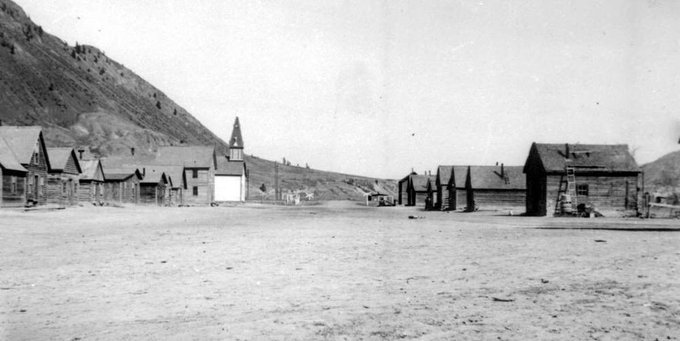
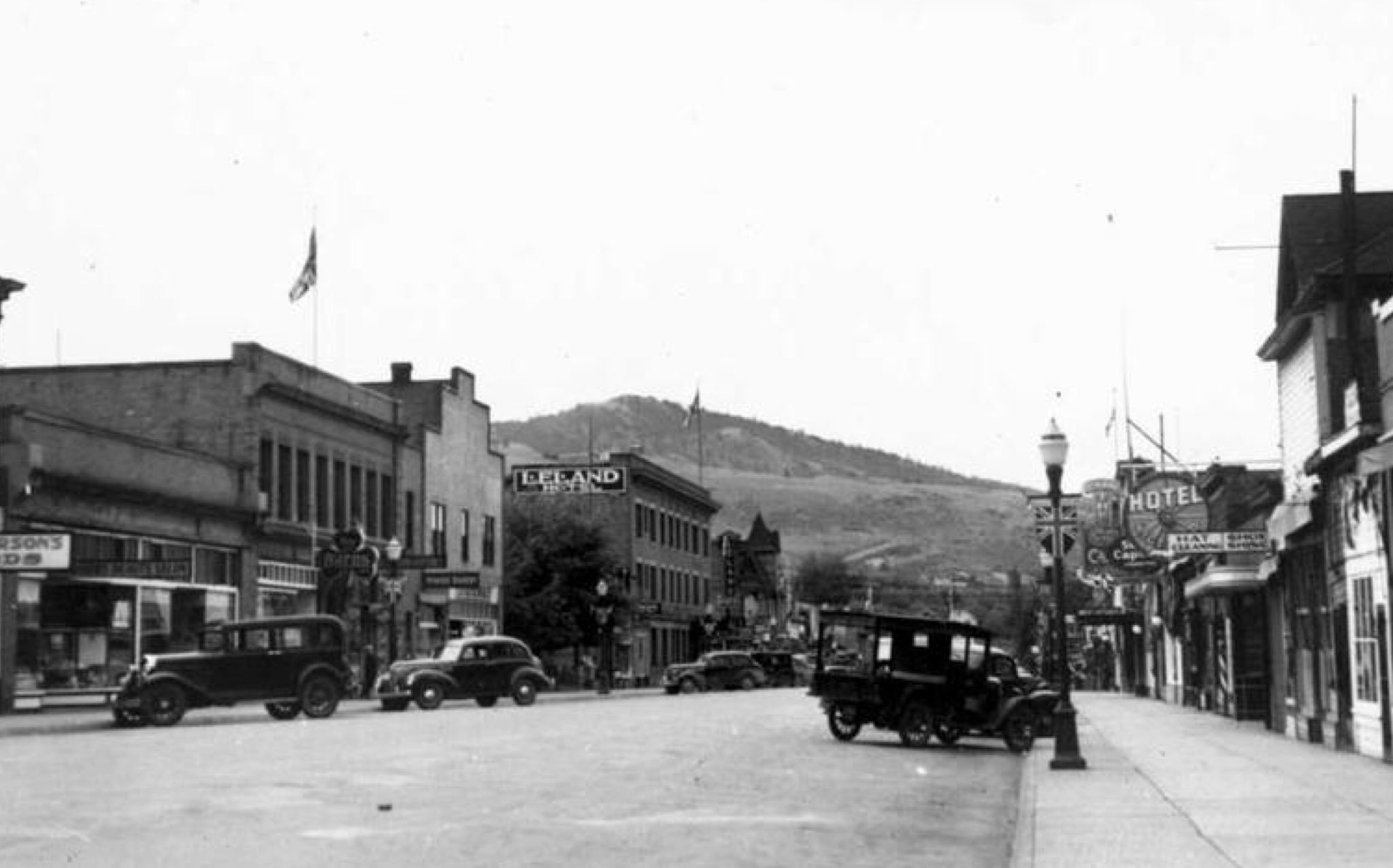
Left, Kamloops Indian Reserve 1, right, downtown Kamloops, both 1939. Kamloops Museum and Archives photos

All this has allowed Canadians to maintain a skepticism of what Indigenous peoples have suffered through colonialism, and has protected us from the truth of our role in it. We have a void in our historical understanding because we have not been shown enough “hard evidence”.

Archaeology has long been used to provide this evidence. Every day in BC, and across Canada, archaeologists document the remains of Indigenous pasts, using the tools of western science to confirm exactly what Indigenous peoples have told us about their land use and occupation.

Ground penetrating radar (GPR), used at Tk’emlups recently to identify the unmarked graves of 215 children forced to attend the church-run, government-funded residential school, is one such tool. GPR works by sensing soil anomalies created by disturbances like digging or burying things. It’s not an x-ray—it can’t “see” bones. When identifying burials, it detects the voids left by turning over soil, indicating the presence of the grave shaft rather than the contents of the grave. While other remote sensing tools may help refine the preliminary evidence, ultimately there is only one way to know with certainty what lies beneath: digging it up.

GPR wasn’t the only data used at Tk’emlups. Here, the researchers’ most important source of information came from survivors themselves. Given the reprehensible failure of the Catholic order who ran the schools to produce records of the deaths, and the impotence of the Canadian government to compel them to do so, survivors’ accounts are the main data on the fates of children disappeared by Canada’s residential school system. It was their knowledge of what happened to them that guided this research—as it should be for any subsequent work here or elsewhere.

In a both a physical and a figurative sense, the work at Tk’emlups is probing the voids of our collective historical understanding. It has revealed a yawning gap between how Indigenous peoples have experienced settler colonialism, and how Canadians see it.

The work that comes now will be heavy indeed. Secwepemc and other Indigenous communities in BC will decide how best to bring peace to survivors and families, and will require Canada’s and BC’s support to follow through. Indigenous communities across the country will face the same decisions as they confront what lies beneath the grounds of other residential schools.

Canadians, as individuals, governments, corporations, universities, and school boards, will need to face the void in history that colonialism has nurtured. That means honestly examining our relationships to the Indigenous nations whose territories we occupy, educating ourselves and each other about the history we’ve denied. The only way to know for sure what’s there is to dig it up.

Digital archaeology goes paperless

Archaeology is a pretty old science.

People have been practising archaeology in some form or another for hundreds (arguably thousands) of years.

One of the hallmarks of archaeological practice is documenting everything we see, everything we did (or didn’t do) and how, exactly, we did it.

University libraries, archives and museums around the globe are filled not only with the belongings, or artifacts, of past cultures collected by archaeologists, but also with mountains of paper field notes, maps, photographs, negatives, slides and reports.

Until the late 1970s to early 1980s, archaeologists used paper notebooks, various field instruments, film cameras and typewriters to document their research.

Site maps and locations were painstakingly prepared using compasses, transits and measuring tape. Rolls of photographs were taken, developed and archived to document archaeological projects and sites. The vagaries of field conditions often meant archaeologists would not know if their photographs turned out until after they returned from the field.

The digitization of archaeology began with the more widespread accessibility of computer and software applications in the 1970s, which became mainstream in the 1980s.

Digital file storage and a backspace key that could actually erase a mistake saved untold hours of re-typing pages.

Spreadsheet software allowed archaeologists to compile and analyze large amounts of data that previously had to be done manually.

The 1990s and 2000s saw several key technologies become mainstream practice in archaeology.

The digital camera allowed archaeologists the ability to take as many photos as they wanted and to view them immediately.

Global positioning systems (GPS) and handheld GPS units meant archaeologists could now navigate to and plot sites much more accurately and with less effort than before.

Modern digital surveying equipment meant archaeological sites could be mapped more accurately and with more detail than ever before. Archaeologists (often with assistance from trained technicians) could digitally map and analyze the spatial relationships of sites with modern geographic information systems (GIS) software.

The widespread adoption of the internet allowed archaeologists to share and access digital archaeological information more quickly and in new ways.

Many governments began providing archaeologists, Indigenous groups and other land users with online archaeological databases, mapping applications and report libraries to aid in research and archaeological resource management.

Despite this, nothing had quite replaced the trusty notebook, compass, tape measures and paper maps.

The 2010s and 2020s saw another wave of technological innovation that is changing how many archaeologists practise fieldwork.

The widespread use of high-precision 3D mapping of the landscape (called LiDAR) has allowed archaeologists to find lost cities in the Amazon rainforest without ever leaving their comfy office chairs.

The rapid evolution of handheld computing (tablets and cellphones) and the resulting proliferation of apps have combined many tools (camera, GPS, GIS software, notebook, and maps) into one integrated device.

The development of cloud computing and virtual work spaces has allowed archaeologists to bring GIS tools, databases and mapping software into the field.

The falling cost of survey-grade GPS receivers has made these powerful mapping aids more accessible to archaeologists.

It is now possible to conduct all aspects of archaeological practice without needing a single piece of paper.

Done correctly, digital archaeology saves countless hours of searching (in libraries and jungles), transcription, scanning, data entry and forests of paper.

Site maps are more accurate and quicker to produce in a GIS, especially when field mapping is done digitally.

Many archaeologists have traded in some of their skills in map and compass navigation, drawing and sketching for coding and geographic information systems certificates.

Museums, libraries, archives and governments are trading in their stacks for server farms.

The last 40-ish years of archaeological practice has been a transition from analogue to digital. The next generation of archaeologists will be digital archaeology natives.

I’ll still carry around my notebook and compass though, just in case.

Ramsay McKee is a Kamloops-based archaeologist.

Ten stories of the ancient world

Like most of our readers, I have spent more time at home over the past year than in the field doing archaeology. That’s given me a lot more time to catch up and connect with archaeology and archaeologists have been getting up to around the world, and at home. This week’s Dig It is a tour of some of the stories from the past that have caught my eye this year—around the world and at home.

1.      Food forests of the BC Coast. Forget farms, a team of archaeologists and ecologists working on BC’s coast have been able to identify food forests, the remnant ecosystems created by Indigenous peoples near village sites. The studied patches exhibit not only higher biodiversity than surrounding landscapes, but contain larger numbers of valued food species such as berries, nuts and roots, seen as compelling evidence of deliberately manipulated environments even 150 years after contact.

2.      World’s oldest coppersmiths? Studies in the Great Lakes region have unearthed evidence for a widespread and flourishing tradition of copper manufacturing that began as early as 9,500 years ago. The research suggests that North American metallurgy may be as old—or older—than copper-working cultures known to have lived in the Middle East around 8,700 years ago.

3.      The oldest garbage. A new archaeological dating technique has identified what could be the oldest garbage dump in the world. Located on the South African Coast, a deposit of marine shellfish and ostrich eggshell over 12 feet deep has been dated to more than 100,000 years old, evidence that early humans were successfully exploiting marine and foreshore ecosystems for much of their dietary requirements. Sites of this age are beyond the range for traditional radiocarbon dating, and used a new technique involving measuring uranium decay in the egg shells.

4.      Secwepemc roots in Riverside Park. The City of Kamloops and Tk’emlups te Secwepemc collaborated in a proactive study of heritage in Riverside Park, resulting in the identification of four previously-unrecorded archaeological sites. The work shows continuous occupation of the area by Secwepemc ancestors for over 4,000 years.

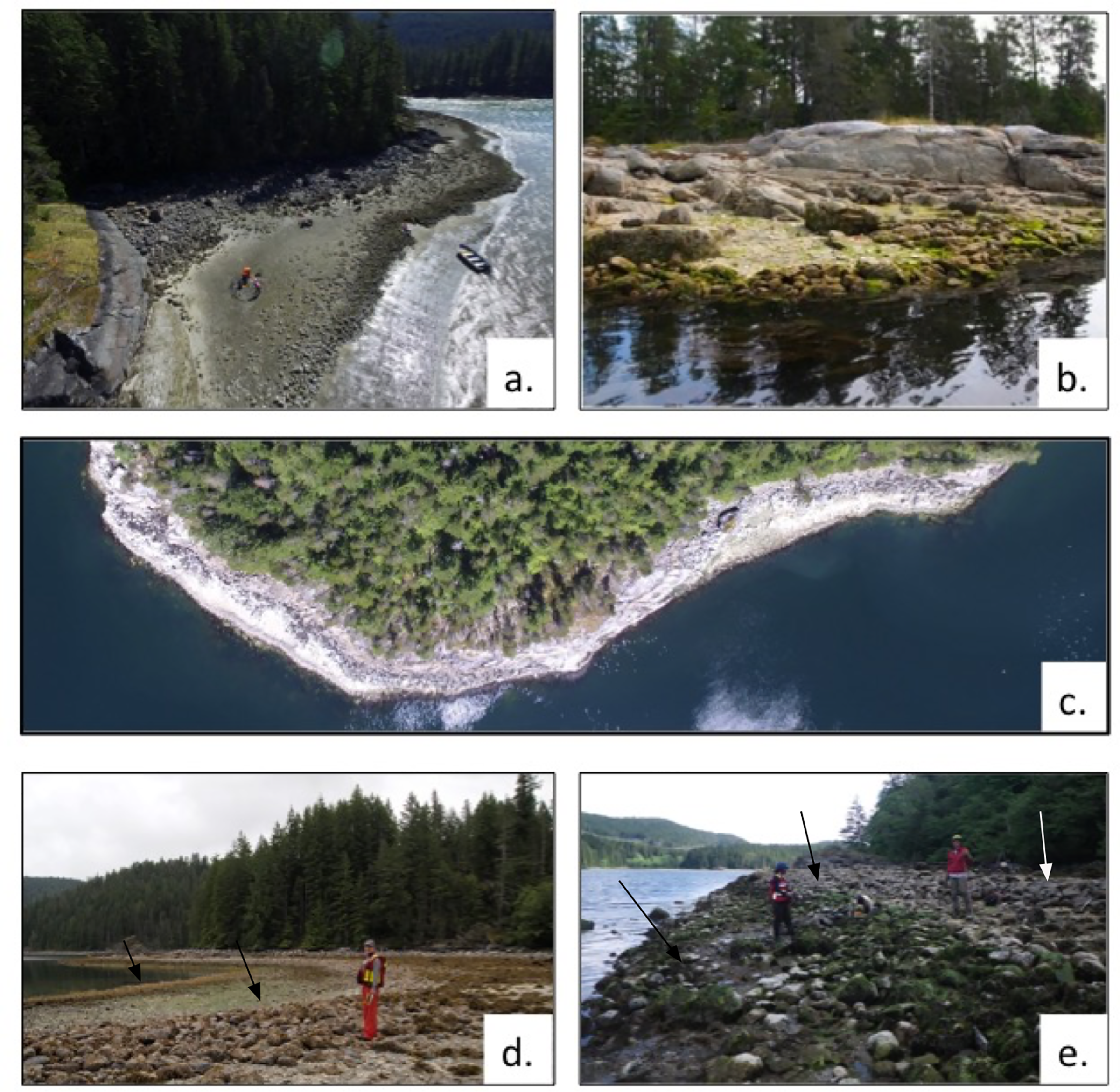
5.      Clam gardens. Researchers have mapped and dated a series of ancient mariculture (sea-based cultivated) features known as “clam gardens” on Quadra Island, in the territories of the Laich-Kwil-Tach and northern Coast Salish peoples, dating back to 3,500 years ago. These beaches, modified by humans raking beach soils and building stone berms around clam beds, are found to increase clam productivity by as much as 300%, creating a sustainable and reliable food supply for large residential populations.

6.      Playing with fire. A study of soils and artifacts found on ancient landforms at Lake Malawi, in East Africa, archaeologists have found what looks like the earliest evidence of humans changing ecosytems with fire. Studying changing kinds and levels of pollen and charcoal, researchers found that around 92,000 years ago, inhabitant’s use of fire shifted the local environment from a predominantly forested biome to a mostly open savannah. The strategic use of fire by agriculturalists and hunter-gatherers is recognized the world over.

7.      A comet and human resilience. Archaeologist have taken another look at a well-known Syrian paleolithic archaeological site excavated in the 1970s and found that it was obliterated by comet about 12,800 ago. The event, which created atmospheric air-bursts as powerful as nuclear blasts over the village site of Abu Hureya, incinerated the hunting-and-gathering settlement’s structures and inhabitants, and vaporized the soil, leaving microscopic traces of meltglass behind to tell the tale. And humans being humans, the site’s surviving occupants returned to reestablish a new settlement—this time focused on farming cereal crops—in the exact location of the levelled village. The effects of the cosmic impact are believed by many archaeologists to have contributed to a climatic shift that ended the last Ice Age and may have kicked off the agricultural revolution.

8.      Neanderthals found in Italy. The remains of nine Neanderthals have been found in a cave near Rome, which was sealed off during a landslide 50,000 years ago. The finds near Rome, which date from about 50,00 to 100,000 years old, represent a spectacular trove of data for scientists to study the very human details of Neanderthal life, as well as the history of a number of fossil animals found in the cave.

9.      Indigenous farming in southern Manitoba. A collaboration of professional and volunteer archaeologists have found gardening tools that suggest Indigenous people in what is now southern Manitoba had taken up cultivation of plants prior to European colonization. The find centers on bison shoulderblades (scapula) fashioned into hoes and used to till soil. The study is preliminary, and more work—including sampling the soil to identify the types of plants people were cultivating—is planned.

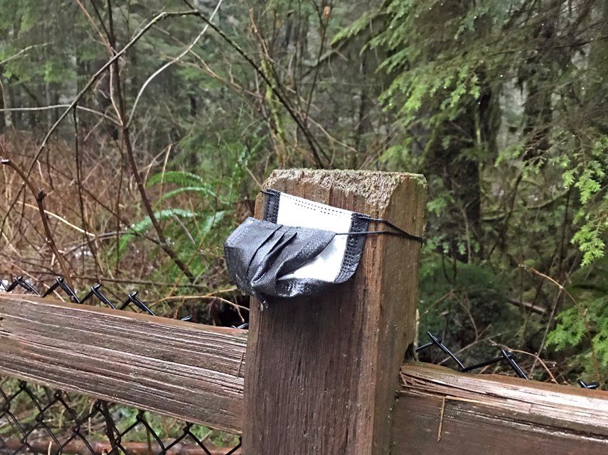
10.   The archaeology of COVID-19. Vancouver archaeologist Bob Muckle and his team are documenting the material culture of covid-19 in the city, with an archaeological project collecting evidence and images of the physical manifestations of the pandemic. Their look at the archaeological record of the Covidian period goes beyond the now-ubiquitous mask litter and covers art and structures related to the pandemic.

There’s history in the stuff that makes you sneeze

Pollen.  I am sure just reading the word makes many a reader’s nose itch and eyes water.  Seasonal allergies are the bane of many an existence this time of year, including my own. But besides the obvious environmental need to allow plant species to reproduce, pollen can also serve a special purpose for archaeologists. 

Palynology is the ‘study of dust or of particles that are strewn’.  Previous Dig It articles have discussed sediment and stratigraphy (the layering of sediments) used to interpret archaeological sites.  The same principal can apply to palynology; pollen grains get dispersed in the wind at certain times of year, accumulating both in water and on the ground surface.  The landforms build and change over time, trapping the pollen spores like layers of cake being saved for later, with each layer capturing a unique signature for the plants present and releasing pollen at that time.  Taking column samples (basically a vertical cylindrical column of dirt) in an archaeological site, and having a professional analyze the pollen grains trapped in those layers, can tell us quite a bit about that archaeological site and the conditions surrounding the people who lived there.

A well-trained expert will examine the tiny pollen particles under a microscope and tell us what plant species they came from.  This is especially interesting because the plants we see present in an area in any given area now are not the same as they have been across time.  Some grasslands were once forested, and some forests were once wetlands or lakes, and often vice versa.  We can see how a single location has undergone environmental transformations through time based on the plant species present, and how that affected people’s behaviour and the options available to them for food and shelter. It’s tough to find bison to hunt in an area that’s heavily wooded, and it’s hard to build homes using wood in areas with no forest!

The seasonality of a site, the time of year it was occupied, is another important factor that can be determined through palynology.  We know plants are generally only available certain times of year and seeing evidence (or a lack of evidence) of these plants in sediment samples from an archaeological site can tell us what season(s) that location was utilized in the past.  This in turn can show human migration patterns, on both large and small scale.

Pollen analysis can also show the importation of plant species and trace the domestication and cultivation of plants if pollen identified within an archaeological site doesn’t appear to correspond to an environmental event.  And if there has been domestication of animals, pollen can also tell us what people were feeding their livestock.

Skara Brae, an ancient site in Scotland where pollen analysis has shown pollen grains that represent the cultivation of plant species that may have been used to brew beer thousands of years ago.

And last, but certainly not least, palynology can bring back recipes thought lost forever.  While doing some digging for this article, I came across a story that shows the testament and grit of the human spirit… In the Middle Ages in Europe the two remaining brewers of an ancient Celtic heather ale chose death over revealing the secret ale recipe to inquisitive raiders.  And so, the recipe died with them.  But many hundreds of years later, a shard of pottery from an archaeological site in Scotland contained pollen grains that allowed palynologist Dr. Moffat to identify the components of said heather ale.  While he wasn’t able to determine the proportions of each ingredient from this analysis, he experimented and brewed what he described as ‘a very drinkable alcohol, comparing quite favourably with beers available in various Edinburgh hostelries.’  A Scottish distillery has been further experimenting with the recipe in the hopes of making it commercially available.

So, while you sneeze and sniffle and curse the pollen blowing about in the wind, give a thought to how future archaeologists will use palynology to interpret our present day lives, and maybe even brew an ale or two.

Animals as unlikely archaeologists

Archaeology interest stories regularly appear in the news around the world when a captivating or unusual find is unearthed. Just recently, an article appeared in The Guardian titled “Welsh rabbits serve up prehistoric finds on tiny Skokholm Island” (published online March 25, 2021). While digging a burrow, a family of rabbits inadvertently dug up prehistoric artifacts on a tiny island outside of Wales. The artifacts included a lithic (stone) artifact that is approximately 9,000 years old as well as a shard of a bronze age burial urn approximately 3,750 years old.

This type of story makes for a fascinating read and often piques the public’s interest in archaeology. Because the items that were unearthed by the rabbits in this particular circumstance were of a certain style that could be attributed to date ranges almost 5,000 years apart, it highlights the use and occupation of this tiny island spanning millennia.

This type of fortuitous archaeological site discovery is not uncommon, even in our backyard in Kamloops and surrounding area. Rabbits, reptiles, rodents, and other small mammals often burrow through archaeological sites and occasionally artifacts are identified at the entrances to animal burrows or dens or within rodent mounds.

Finding these items during an archaeological survey can be incredibly helpful. Most archaeology projects are related to proposed developments and involve multiple stages of work. Typically, the first stage is a pedestrian survey of the entire proposed development by an archaeological team. This first stage may not be conducted under a Heritage Conservation Act permit, which means that the archaeologists cannot dig shovel tests and screen the soil to search for buried artifacts (the typical way archaeological sites are discovered).

Instead, the archaeological team surveys the terrain on foot and identifies areas to shovel test in the future once a Heritage Conservation Act permit is obtained. While surveying the proposed development, the archaeological team carefully examines the ground to search for artifacts that may be visible on the surface or eroding out of subsurface exposures. Small mammal burrows and rodent mounds are carefully inspected as these areas of recently overturned soils can potentially expose artifacts or buried cultural features, such as the remains of cooking hearths.

Additional subsurface exposures are also examined, whenever present, during archaeology surveys such as tree throws, stream banks, road cut banks, and wildlife trail beds. The discovery of artifacts on the ground surface or in subsurface exposures during the early stages of a proposed development can facilitate project planning by identifying archaeological sites early on in the process. Natural subsurface exposures allow archaeologists a view under the ground surface without actually digging into it with a shovel.

Archaeologists cannot collect artifacts without a Heritage Conservation Act permit in hand and so if artifacts are discovered in an animal burrow, the artifacts are recorded with a GPS unit, photographed, and described, but ultimately left in place.

There are archaeological sites exceeding 10,000 years of age in this region that are yet to be discovered. Rabbits, marmots, moles and the like can be helpful assistants in unearthing archaeological finds and providing us a glimpse beneath the ground surface and into the past.

Animal stories from beneath the soil

The study of how people used and interacted with animals in the past is called zooarchaeology.  Animal remains in the form of bones, teeth, antler and horn, and shell can tell us a great deal about people’s adaptions relating to subsistence activities and how they changed through time. 

The first step is identifying what elements and animals are represented in a site.  Very rarely are complete items recovered, as most are found as small pieces due to cultural and/or natural factors.  Archaeologists must determine if the fragments can be assigned to certain elements, such as a femur or molar. From there, efforts are made to classify the animal to the most specific level possible (e.g., mule deer, freshwater mussel, salmon, waterfowl, turtle, etc.).  The result is an inventory of the various animals harvested, processed, and/or consumed by the site inhabitants

The presence and distribution of animal remains with characteristics relating to skinning, butchering, and cooking allows archaeologists to interpret the kinds of animal processing taking place, how people organized their subsistence activities (e.g., butchering and cooking in separate site areas or separate sites), and the intensity of the activities.  

For instance, skinning and disarticulating a carcass often left cut marks from stone knives near the ends of limb bones or smashing marks from choppers on rib bones. Roasting over a fire often resulted in bone burning.  Calorie-rich marrow was harvested by breaking bones with stone hammers, leaving impact marks and curving fractures.  Grease rendering involving bone boiling is often represented by concentrations of highly fragmented bone.

The archaeologist may note that certain elements are present or absent in a site.  One interpretation of this situation is that hunters engaged in selective butchering and transport activities when large animals were killed a distance from camp, or many animals were harvested without enough time to process all the meat before spoilage.  Those portions removed and taken to the camp are interpreted to have high subsistence value, such as those containing the ribs and the limb bones, while those left behind at the kill site are interpreted to be lower-value.

Archaeologists also attempt to ascertain how many of each animal is present at a site.  This is done by selecting the most highly represented element of each animal. For instance, there may be 11 femurs from elk in a site occupation, of which seven are right side femurs and four are left side femurs. The basic interpretation would be that a minimum of seven elk are represented because the four left femurs would be considered partners to four of the right femurs.  Further, this amount would represent an intensive hunting and processing activity providing the site inhabitants with significant amounts of calories and manufacturing materials.  By conducting such an analysis, it is possible to make interpretations about the relative importance of animals to inhabitants or availability of certain animals in an area, and the levels of effort spent on pursuing the identified animals.

The seasonal variability in animal availability or anatomy can be used to interpret the time of year for site occupation. Sockeye salmon are seasonally migratory so the recovery of large numbers of their bones point to a fall harvesting period.  The presence of an adult male deer skull lacking antlers indicates it was harvested between January and April, the period in which antlers were shed and before they grew back.  While radiocarbon dating may reveal a site is 4,270 years old, analysis of animal remains may determine that people lived there between September and November.

Oh, the stories those old bones can tell.

Call Before You Dig: Understanding BC's Heritage Conservation Act

As an archaeologist, the Heritage Conservation Act (acronym HCA, or sometimes just referred to as the Act) is the main guide to what I do. Similar to many legislative documents, it is a bit overwhelming and tedious to read, but vital to understand. Every province has their own version of the HCA, so one must be aware of the provincial regulations specific to their work environment.

Creating regulation for the conservation of heritage property in British Columbia started back in the 1860s. At that time, archaeological processes were focused on colonial regulations, and were not developed in consultation with First Nations. In the 1960s, new regulations were created, but the collaboration with First Nations was still absent. Following the rise of Cultural Resource Management in the early 1970s, the first version of the HCA we know today was written in 1977 and is currently administered by the BC Archaeology Branch. In 1987, First Nations were finally involved in the changes to the HCA. The most recent changes to the HCA took place in 2019, after 20 years with no revisions.

The purpose of the Act is to encourage and enable the protection and conservation of heritage property. Heritage property is a designation applied to land which the Ministry of Forest, Lands, National Resources Operations and Rural Development (FLNRO) deems to have heritage value – the historical, cultural, aesthetic, scientific, or educational worth or usefulness of a site or object. Locations with evidence of past use that pre-date, or are assumed to pre-date, 1846 are protected under the Act, and some sites, such as human burials or shipwrecks, are protected regardless of age.

There are various ways of determining if a property has heritage value. There is a government run database called Remote Access to Archaeological Data (RAAD), which archaeologists, First Nations, and industry representatives can apply for access. The database comprises an interactive map containing all archaeological sites that have been registered with the Archaeology Branch through the submission of ‘Archaeological Site Inventory Forms’.

For areas where no data has been collected, a heritage inspection or investigation may be required. This is to assess the archaeological significance of the land, determine the presence of archaeological sites, and recover information that might otherwise be lost through alteration or destruction. In order to carry out the inspection or investigation, an archaeologist has to obtain an HCA permit from the Archaeology Branch. In the vast majority of cases, the permit must be held by an archaeologist meeting specific professional standards. These permits have an extensive list of requirements, following strict guidelines outlined in the HCA. If a site has been identified and cannot be avoided during development, a Site Alteration Permit must be obtained, which authorizes modifications to the archaeological site.

One of the biggest changes to come about in 2019 was the requirement to have heritage inspections conducted if deemed necessary by the minister. This means that more areas are required to have a heritage investigation conducted before commencing land disturbance. The proponent (individual or company) requesting the alteration of land is required to pay for the cost of the heritage investigation. Another change is the enforcement of consequence for the disregard of the HCA. There are now written penalties, power to obtain warrants, application of stop work orders, and the ability of to suspend or cancel permits, among other methods, to enforce the regulations in the HCA.

Heritage property is a non-renewable resource. Once it is destroyed or altered, we lose context and information, artifacts are destroyed, and cultural heritage is lost.  Now that you understand a bit more about the rules, I encourage you to call before you dig – an archaeologist, that is. Help us mitigate the destruction of the thousands of years of history, hiding just below the surface.

Playing hide and seek with history

If only I could have a dollar for every time I am asked why there is no easy way for a non-archaeologist to determine if there is a recorded archaeological site on a property.

It should be easy, right? After all, every property is precisely surveyed and displayed in online mapping applications and there is also an online repository that shows the location of all recorded archaeological sites. It would be a trivial exercise to automatically merge these and let every landowner know if there is a recorded site on their property.

Alas, it is not this simple.

Until the late 1970s, the primary mindset for B.C. archaeologists was to increase the overall knowledge of archaeological sites across the landscape.

This was achieved through a rapid expansion of the known site inventory by completing large-scale surveys of specific geographical areas, such as the banks of the South Thompson River.

At that time, there was little thought given to the potential consequences of having an archaeological site on one’s property and sites were not mapped to legal survey standards.

This “let’s find as many sites as we can” focus also left little time to conduct subsurface work, such as shovel testing to find buried archaeological deposits, so these sites tend to only be recorded from what could be seen on the surface.

The result? A rich legacy of very interesting archaeological sites recorded across the landscape, with only an approximate idea of their actual size, shape and location.

Following the early inventory period, the drivers of archaeology shifted so that more and more of the work was development-driven.

Archaeologists were now going out into the field with maps provided by their clients, armed with an increased awareness that knowing the size, shape and locations of sites was now of heightened importance so the client could manage the impacts to those sites.

Much of the work during this era was conducted before the Global Positioning System (GPS) was available. Sites were quite accurately plotted in relation to the development plan maps, but often were only approximately located on the smaller scale maps that the B.C. Archaeology Branch was using at the time.

After this middle period of archaeology, from about the 2000s to the present, widespread availability of GPS technology allowed ever more accurate maps to be created. It was during the transition into this era that the B.C. Archaeology Branch moved from paper-based to digital maps.

This was a huge undertaking that took many years to complete as there was a backlog of more than 20,000 recorded sites to contend with, along with an ever-increasing tide of newly recorded sites that continued to flow in year after year.

In the end, it was realized that there was just not enough time or resources to accurately relocate every one of these old sites. In many cases, there was simply not enough information.

Finally, it was decided that the only workable process would be to locate these sites as best as possible in the new online map catalogue. A system was then created to involve professional archaeologists whenever a development referral was found to overlap, or be close to, a recorded archaeological site.

Following is a case study to illustrate a typical example of this process.

\The brown polygon to the southwest in the inset map shows the shape, orientation and location plotted in the B.C. Archaeology Branch database for an archaeology site recorded in 1992. In 2015, I was asked by a client to assess this site in relation to a proposed development.

The development map showed the site located approximately 200 metres to the northeast, as shown by the cyan blue polygon on the inset map.

Obviously, something was amiss.

While doing the background research, I discovered another archaeologist had visited the site in 1997. I took the location map from the 1997 report and overlayed it onto Google Earth and found that it showed the site to be very close to where the development plan indicated, as shown by the red triangle on the inset map.

There was also a detailed hand-drawn site map in the report that indicated the location of the site in relation to nearby roads and landforms.

Armed with this information, I visited the project area.

First, I confirmed the site location, size and orientation plotted in the B.C. Archaeology Branch database was indeed incorrect. Then, I took the 1997 site map and matched it to roads and terrace edges, confirming the development plan and 1997 report map generally agreed.

Finally, I remapped the site with an accurate GPS. The red polygon shows this refined site location.

Unfortunately, this experience is more common than we would wish when dealing with archaeological sites that were recorded well into 1990s. Often, an hour or two of background research is all it takes for an archaeologist to determine how well plotted an archaeological site is, in relation to a property.

The widespread availability of GPS technology and applications such as Google Earth are important tools for archaeologists to determine the accuracy of a plotted archaeological site.

Tens of thousands of archaeological sites are distributed across B.C. and accurate mapping is an essential aspect of managing this important and non-renewable resource.

Clinton Coates is a Kamloops-based archaeologist.

#YKASTRONG: trending since time immemorial

As most archaeologists can attest to, usually, when you show an artifact to a member of the public, people are polite, but often I can see one question on their face: Why should I care? I am hoping to inspire an answer to that question, in around 700 words.  

Archaeology is more than just (super cool) pointy rocks. Archaeology is the study of humans and human behavior through the material culture that is left behind. Having said that, often what tells us much about human behavior is what is not left behind.

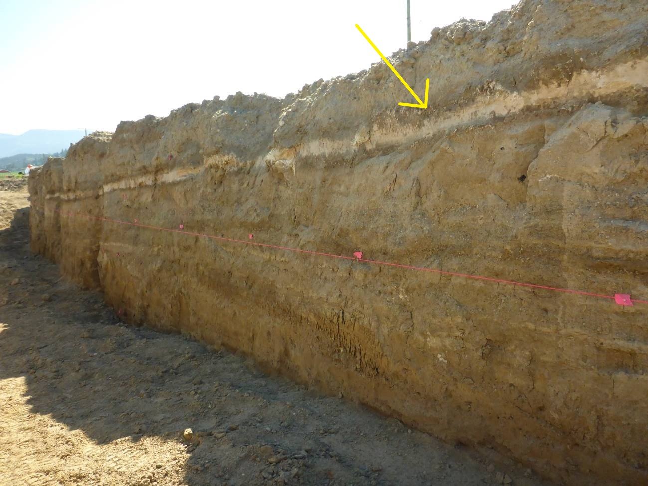
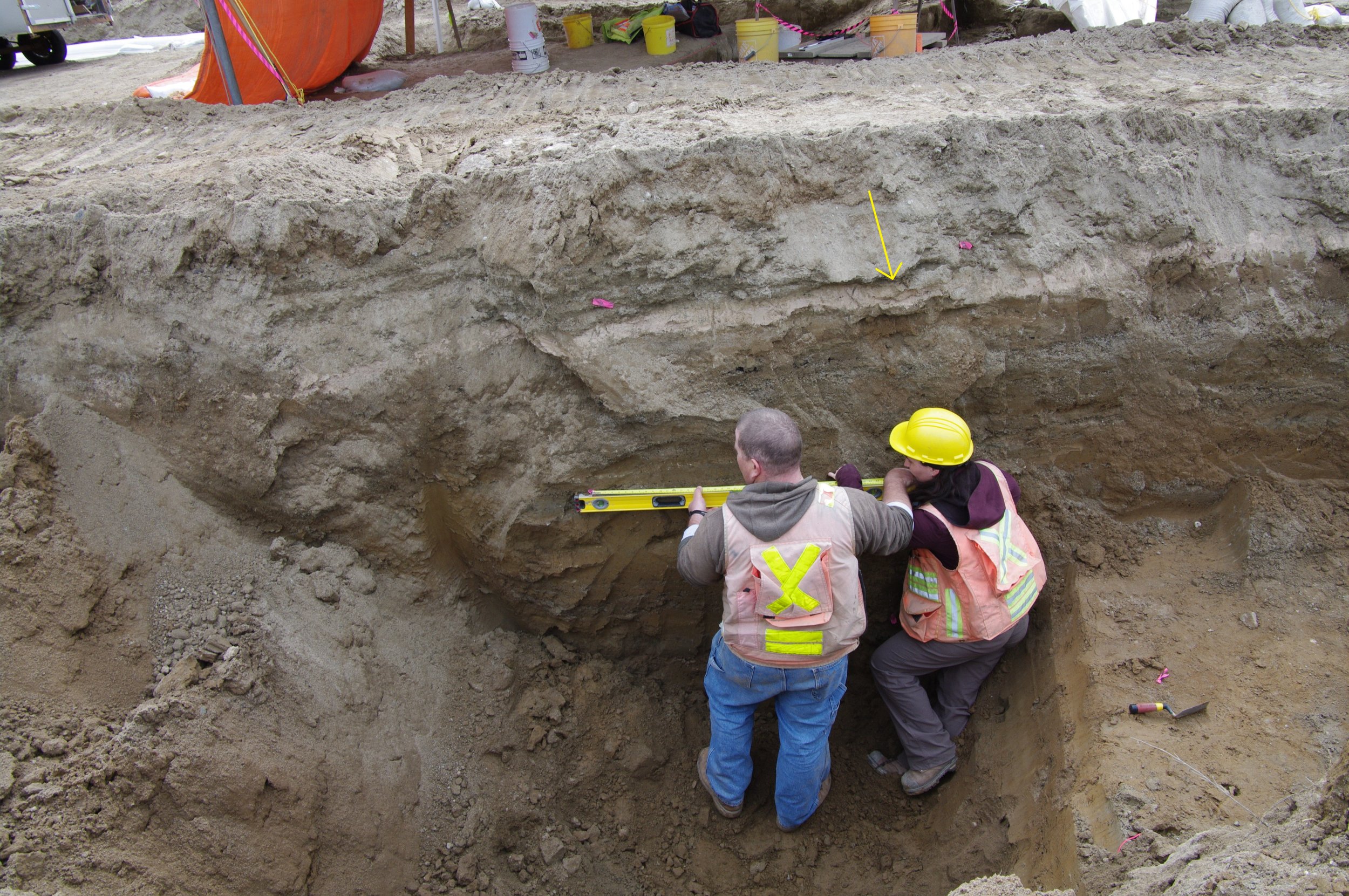
Carbon dating tells us that approximately 6,850 years before present (BP), Mount Mazama in Oregon erupted, creating what we know today as Crater Lake. This eruption resulted in volcanic depositions (or tephra) being flung all across North America, in our case, 1,211 km to right here to Kamloops. This tephra can be clearly seen as a pinkish-white, approximate 10 cm thick layer, mostly in river valleys throughout the Kamloops area. We have identified archaeological sites which display human occupation many years before and after this eruption. And we have seen a lack of archaeological evidence within the tephra layer, and immediately after the event. What does this mean?  

Not a lot is currently known about the impacts that this falling ashy layer would have had on the people who lived here at the time. Based on other eruptions, such as the 1980 Mount St. Helen’s, we can certainly ascertain that the rapid deposition of this volcanic tephra could have caused chemical changes in the soil and water, resulting in the disruption of localized vegetation, wildlife and aquatic life.

There is evidence of mass landslides, as well as the re-routing of creeks and streams, as a result of this volcanic-ash deposition. All of these possible variables combined, one starts to imagine the overall stress to the local ecosystem. In terms of resource procurement, if food and other resources declined in a particular area, people would have had to go elsewhere to get what they needed. It is easy to imagine what this type of stress would have looked like. Take into consideration how your behavioral patterns change when a staple item in your household is not available at your usual grocery store. Do you drive around town, stopping in different stores trying to track it down? Or just go without?

A more recent example of massive environmental stress that we have experienced locally were the 2017 Wildfires in BC. Although the fires did not burn within the City of Kamloops, they were close enough for most of us to consider them local. The short-term implications for people living in evacuation zones meant a loss of home, and ensuing temporary relocation to a safe zone. Resource procurement came differently to evacuees – many people had no choice but to rely on charitable donations to meet their basic survival needs. Human kindness at the time was palpable – everyone wanted to help and offered what they could. In following years, the forestry and logging sector made massive adaptations to preserve the industry. Why? Because the harvesting of resources puts money in pockets and food on tables: people gotta eat. 

Although Covid-19 is not really an environmental change, it has resulted in a mass disruption to day-to-day life that we all can relate to. We, like the people living in this valley 7,000 years ago, cannot gather in the spots we used to, in the ways we used to, with the people we used to. Our supply chain has massive changed, from shortages (the 2020 toilet paper crisis) to changes in shopping patterns (locally or online). The challenge of adapting to resource shortages is a struggle that humans have faced since the existence of our species. Kamloops has been here before, and we have adapted. The archaeological record shows us that.

I study archaeology because of a desire to understand and connect with people. I am honored to record and interpret a piece of history, to learn from unwritten records, and tell the stories of past peoples. The “mundane” day-to-day struggles are at the foundation of what makes us human; it’s the day-to-day that defines humanity.  

I am not going to finish off this piece by telling you why you should care about archaeology. I want you to think of how you should care about archaeology. What parts of your life can be bettered by the knowledge of past peoples? I guarantee you, there is something archaeology can offer that you can relate to.

Archaeological discoveries with wow factor

Nearly everyone I meet has at least some interest in archaeology. We benefit from adventurous news and articles showing ancient, lost cities and intrepid archaeologists braving the jungles and deserts of our planet.

The reality, of course, isn’t quite as glamorous, but we can still be interesting guests at dinner parties.

I suspect all of my colleagues have similar experiences at social gatherings (back when we had those), when meeting new people or, even, when getting a speeding ticket (true story). The inevitable question we are asked is: “What is the most interesting thing you have ever found?”

The question prompts a pause, followed by: “Well, that depends.” Different things are interesting for different reasons and, based on responses and reactions over the years, I’ve made the following observations.

Really old things are interesting, and if you’re looking for the “wow” response: the older the better.

Several years ago, I worked on a field project in central B.C. that resulted in the collection of hundreds of formed, stone tools. There were projectile points spanning the known pre-history in the region, as well as various other stone tools. Some of the smaller sites contained all the requisite ingredients for a perfect animal kill and butcher location — the projectile point used to kill the animal, a scraper used to process the hide and some burned bone fragments from where the animal was cooked.

However, the coolest find was an unassuming base of a projectile point with basal-thinning or flutes removed from both faces. These characteristics suggest it’s from some of the earliest known tool technologies in B.C. and, likely, in excess of 10,000 years old.

That’s interesting. Even more interesting are really old things that look like something.

The projectile point base described above is really old but requires you to know what you are looking at. Many years ago, I had the privilege of working in Texas and New Mexico, where I worked at one archaeological site that included artifacts attributed to the tail-end of the last ice age.

While the artifacts weren’t much to look at, the mammoth skull at the bottom of the site deposit certainly was. When uncovered, it was upside down and a bit crushed but, still, it looked like a great big mammoth skull. Sure, the site contained a huge amount of data on site formation processes and ancient environments, but the description of the skull always gets the “wow.”

People like to learn new things. In B.C., archaeologists have the advantage of working with Indigenous peoples, who are the descendants of the people that made the archaeology we find.

We can learn from these colleagues about how tools were made, used and why we find them where we do.

Based on oral tradition and teachings from Indigenous communities, the occupation of these lands since time immemorial is beyond refute, but it is sometimes useful to be able to point at places on a map for those who need this kind of information.

For me, the most interesting site I’ve recorded in my career was high up a mountain near Lillooet.

In a small area, we recorded hundreds of culturally modified trees, several roasting pits and found many stone tools.

Two of these stone tools were projectile points that we assigned to time periods from 1,200 to 3,500 years ago. However, the most interesting thing was a culturally modified tree growing out of the rim of one of the roasting pits.

I cored the tree and determined the cambium-stripping of the tree occurred in the 1960s.

All told, we had archaeological evidence showing continued use of the same location (not just the same area or environment, but the same spot) for at least 3,500 years. That goes beyond “wow.”

Matt Begg is a Kamloops-based archaeologist.

Secwépemc calendar welcomes Pellkwetmin (stay at home month)

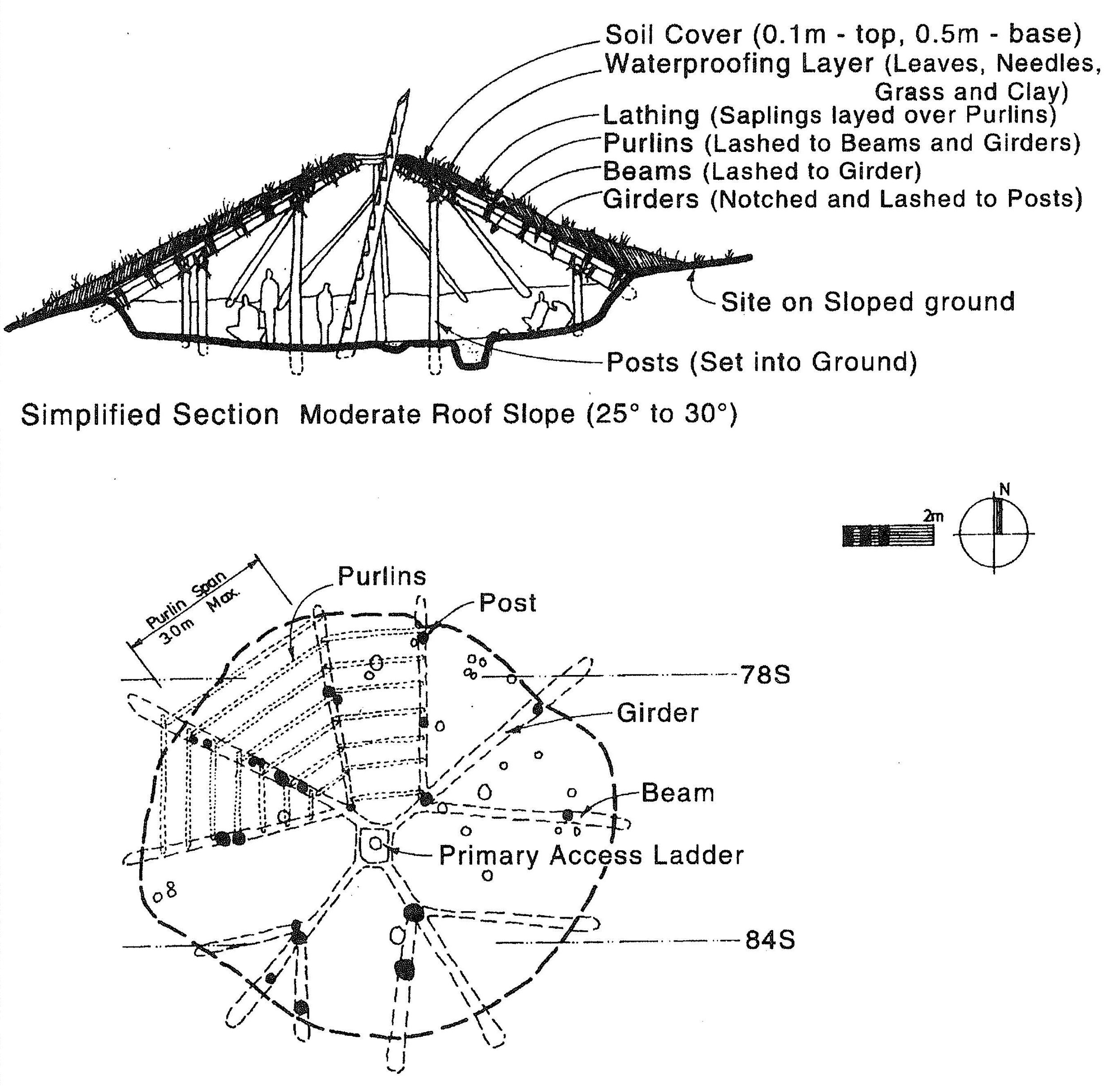
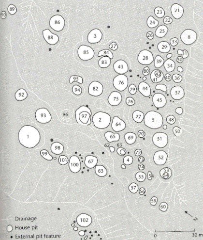
As we move toward the end of this year and into the New Year, we are all adjusting to staying at home, using foods we have stored, making crafts and keeping active with indoor hobbies. For many, this has been a change in lifestyle, but when we look at the archaeology of the Thompson and Fraser River areas, staying home during the winter months was the norm. In the Secwepemc calendar, the month of January is Pellkwetmin, meaning stay at home month. Home was the winter pithouse, organized into villages of various sizes that were distributed along the banks of rivers and lakes. Within a village, houses of different sizes raise questions among archaeologists if house size was an indication of family size and number of people within a home, or, did the size of a house indicate the status of the family. Were bigger houses a direct correlation to family wealth or status within the community? Did larger houses have different artifacts than smaller houses? How were the homes organized and did this differ based on house size? These questions have prompted years of archaeology field schools and academic research at pithouse villages on the BC plateau.  The pithouse village at Keatley Creek in St’át’imc Territory is one of these well-studied villages and provides some insights to the questions asked above.

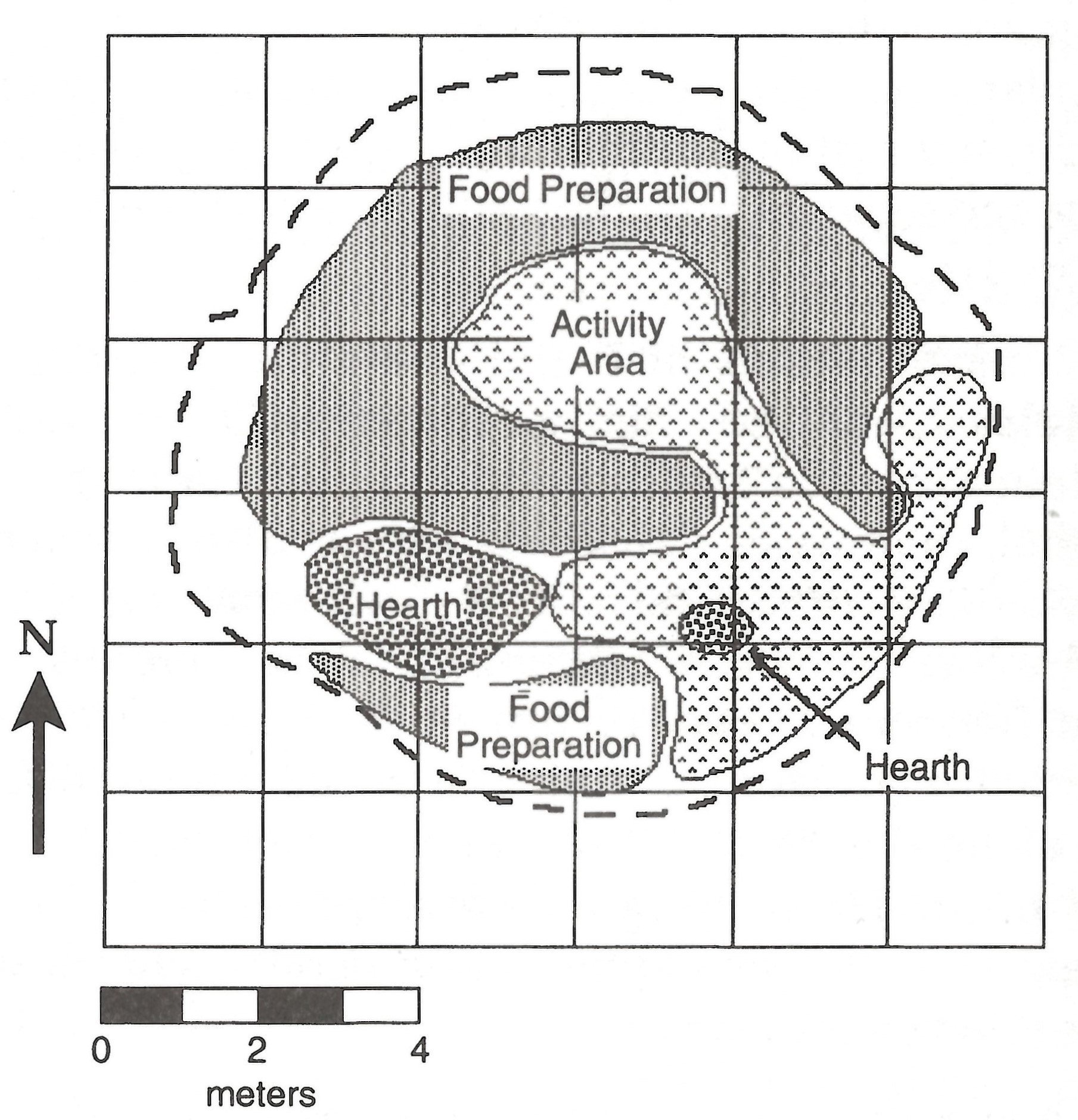
In looking at the organization of house floors at Keatley Creek, archaeologists identified patterns based on the spatial distribution of stone tools and faunal (animal) remains. These patterns were interpreted to represent activities within the house. In considering our own homes, how is the living room different than the kitchen? What ‘artifacts’ would be in each space? One of the ways to test observed patterns of artifacts and interpretations of how households were organized is to looks at soil chemistry from samples taken from the living floors of houses to distinguish between activity areas, such as: cooking, living, or sleeping areas. By analyzing soil samples, a comparison can be made between unmodified soils and soils modified by humans, where humans have occupied an area for long enough to create a new soil that is chemically distinct from undisturbed soils. Higher or lower concentrations of elements such as calcium, phosphorus, strontium, and potassium can be indicators of how a house may have been spatially organized. For example, phosphorus and potassium are indicators of ash and hearths (fire pits) while concentrations of phosphorus, calcium, and strontium can indicate areas used for food preparation and the combination of calcium and strontium is associated with a ‘general activity’ area. By recognizing chemically distinct soils throughout the house and combining that with the distribution of artifacts, archaeologists can be more accurate in reconstructing the use of space for a kitchen versus a living area. Since houses were occupied over many years, archaeologists can also analyse soils from different time periods within the house to determine if the interior space was used differently.

As you move about your house, consider what information you are leaving behind for future archaeologists to study. 

Alysha Edwards is an Indigenous archaeologist based in Lillooet. Nadine Gray is a Kamloops based archaeologist and instructor at TRU.

The oldest neighbourhood in Kamloops

One of oldest neighbourhoods in Kamloops is not where you think it is. It’s not the west end, filled with homes from the early 1900s. It’s not the north shore, where the fur trade fort drew people in the early 1800s. It’s at the mouth of the Tranquille River, under the decaying remains of a tuberculosis hospital, and it’s Secwepemc through and through.

The mouth of the Tranquille River has been a residential centre in this valley “since time out of mind”--archaeological remains there date from around 7,500 years ago right up into the contact period, but it is very likely people lived there much earlier, to around the end of the last Ice Age.

The sites suggest a nearly continuous occupation over these 8 millennia, during which time its residents witnessed massive environmental changes to the valley, the river, the lake, and the climate itself.

Eventually, they saw colonialists come too, and settle, and reshape the place.

But let’s back up.

The archaeological evidence tells us that for countless generations the river mouth was home, first as a basecamp for hunting and gathering activities, and eventually, a thriving village.

What was that life like for them? A preliminary study undertaken in the 2000s documented an impressive density and diversity of remains there that give us a glimpse into the developing Secwepemc lifeway.

The remains of pithomes, the cozy semi-subterranean dwellings that are a hallmark of Secwepemc architecture, point to a settled, semi-sedentary lifestyle to which people returned year after year. Numerous ancestral burials in the area mark a cultural landscape of some significance.

The plant, animal and stone artifacts describe a year-round occupation that thrived on resources available locally, and brought to the area by trade.

Residents enjoyed a diet that centered on deer, but included hare, muskrat, elk, moose, loon, grouse, coot, all harvested from the surrounding hills and wetlands. Salmon, suckers, freshwater mussel and snail were also eaten. Later, chicken, cows and pigs were adopted into the food system.

The remains of fisher suggest trapping for the luxurious fur, and burnt seeds point to processing of locally abundant cherries.

The Secwepemc name for the place, “Pellqweqwile”, derives from the work for biscuitroot (also known as desert parsley, lomatium macrocarpum), an important and valued food that was harvested, potentially even cultivated here.

And dogs were present too, enjoying, then as now, the company of humans--and their warm hearths and table scraps.

The tools found here were used for hunting, fishing, and plant preparation, of course, but also for a variety of other domestic uses, including art and design and construction.

Raw materials for these tools include many types not available locally—like obsidian—that indicate long-distance trade networks going back thousands of years.

It was this well-developed inter-regional trading economy that drew fur traders to the region in the early 1800s, effecting a seismic shift that would change everything.

At Tranquille, the traders found a man called Piqwemús (Pacamoos) heading one of main villages in the Thompson valley, and nicknamed him Chief Tranquille, for his friendly nature. A map drawn by Archibald MacDonald in 1827 shows the river named after him.

Sometime around 1840, Piqwemús died, mysteriously, following an altercation with Hudson’s Bay chief trader Samuel Black (whose subsequent murder is a whole other story). After that, change and dispossession came rapidly: within a year or two the entire Tranquille area—already crossed by the HBC brigade trail between Fort Alexandria and Kamloops—was converted to hayfields to support the traders’ livestock.

By 1858, the Tranquille River valley became a centre of frenzied placer mining, where gold rushers tore up the landscape, unseating fragile salmon habitat that has never entirely recovered.

In the fall of 1862 smallpox ripped through local Indigenous populations, killing up to two-thirds of Secwepemc by winter’s end. The land, never having been sold, surrendered, or treatied, was “opened” for settlement, and the first homesteaders moved in.

By the time the King Edward VII Tuberculosis Sanatorium opened on the site in 1907, the descendants of the Stk’emlupsemc who had occupied it for millennia were relegated to Indian reserves at Kamloops and Skeetchestn, though they continued to hunt and fish there throughout 20th century.

The sanitorium closed in 1958, and reopened the following year as an institution for the mentally disabled. It closed permanently in 1983, and leaving behind about 100 buildings and structures connected by a network of underground service tunnels.

Around and under those buildings and hayfields, the archaeological legacy of the area’s Secwepemc origins still lies. In some ways, the abandonment of the institutions has protected the site, those buildings standing guard over nearly 8,000 years of history.

Over the years, developers have eyed the location, and today, one is pushing ahead with a plan to re-establish a neighbourhood here. To move forward, the developers, the city, and the province must reconcile these thousands of years of well-documented occupation with a century and a half of unlawful dispossession, and work to rebalance relationships that recognize Stk’emlups history.

A notable archaeology discovery near Kamloops

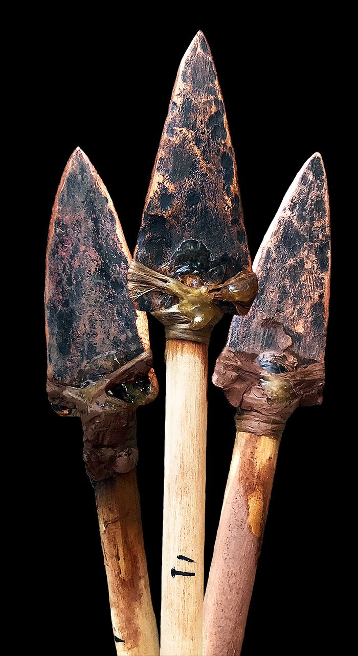
Earlier in 2020, an archaeological survey conducted near Kamloops by the Skeetchestn Indian Band, in collaboration with other local Indigenous communities, resulted in a rare and ancient find — a large spearpoint rarely found in the region and with a poorly understood place in the history of Indigenous occupation of this area.

This spearpoint closely resembles what local experts in the region call an intermontane stemmed point. These points are estimated to have been in use in the region between around 10,500 to 8,500 years ago.

These large, finely made spearpoints have been recovered from very few sites in a broad geographic area in northwestern North America.

In the Southern Interior of British Columbia, only a handful have been recovered during archaeological investigations.

The vast majority have been collected by members of the general public and exist in local museums and private collections.

This type of artifact recovery is problematic; not only is collection of artifacts without a permit issued by the B.C. government illegal, collection by the public usually results in the loss of a wealth of information about the location and environment the artifact is located in (the context).

Just as the climate is changing today due to an increase of carbon dioxide in the atmosphere, the ancient climate changed over time due to natural climatic processes.

The people who used intermontane stemmed points lived in the Southern Interior shortly after the last ice age, called the Fraser glaciation, ended.

At this time, a large glacial lake called Glacial Lake Deadman filled the Thompson River Valley, dammed by an ice dam near present-day Spences Bridge. Much of present-day Kamloops would have been underwater.

The climate was warmer and drier than it is today, with grasslands extending higher into the hills than they do today.

The people who used this particular spearpoint technology between 10,500 and 8,500 years ago experienced dramatic changes to the landscape. Glacial Lake Deadman drained catastrophically at some point during this period, exposing much of the Thompson River Valley bottom.

Once this exposed valley stabilized and grasslands took hold, the vast grasslands allowed large ungulates (deer, elk, caribou and mountain sheep) to flourish.

The people living on this landscape likely focused significant effort on hunting these animals for meat, hides, antler, horn and bone. The intermontane stemmed point was just one of several spearpoint types used during this period.

Archaeologists have hypothesized that different spearpoint types were used by small groups of people from different cultural backgrounds that moved into the Southern Interior of B.C. with their unique tool-making traditions after the retreat of the glaciers.

This hypothesis has been difficult to test due to the rarity of known sites of this age and the illegal removal of the spearpoints and other distinctive artifacts from these sites by collectors — making them much more difficult to pinpoint on the landscape.

The site this spearpoint came from has immense cultural value to local Secwépemc and Nlaka’pamux communities and scientific value to archaeological researchers.

The symmetry and visual appeal of this artifact make it attractive to local collectors.

Luckily, Secwépemc archaeological stewards were able to recover it with the appropriate permits in place before it was removed from its context.

Without this artifact in its original location (in situ), this site may have gone unnoticed — and unprotected.

Ramsay McKee is a Kamloops-based archaeologist.
Barbecuing our way to uncovering history

Archaeologists usually do fieldwork in the summer months (well, the “defrosted” months, anyways…).  Winters are generally reserved for nesting in our offices, drinking gallons of coffee, filling out site forms, and writing reports for all the fieldwork completed during the summer months.  It doesn’t always work that way though…

An archaeology crew has been working regularly on the Big Bar Slide, to complete archaeological assessments at the same time as the emergency response efforts to create a solution that helps the salmon get back upriver where they need to be.  Because it’s an emergency response situation, our work can’t always be planned far enough in advance to complete during the warmer summer months, so we end up doing the dreaded “Winter Archaeology”.

We dread this work, not so much for the less than ideal conditions, but more because it requires so much extra planning, and takes so much longer than the “normal” fieldwork we do.  As an example, I have been working with an archaeology crew recently out near Big Bar to support the emergency response by conducting an impact assessment in advance of a proposed development.  We’ll be out again in the coming weeks to finish. 

The work is remote and the location is challenging at the best of times.  November is not the best of times.  It’s cold, we tend to run out of daylight, the access is limited and the roads can be unsafe.  But through our past fieldwork in the area we have demonstrated that there is a long and rich history of indigenous occupation and land-use, so we must continue, even under these less-than-optimal conditions.

The last round of fieldwork was conducted under full winter conditions with frozen, snow-covered ground.  This makes it all but impossible to use our trusty shovels and dig the tests we need to excavate in order to screen the sediment and find artifacts or features that may be present.  There are several strategies that can be employed in these cases, with the specific choices depending on factors such as the remoteness of the project, project size, and the specific methods allowed by the permit.  In this case, we opted to lay out a very precise grid and defrost the ground at each and every shovel test location.

Using charcoal briquettes.

Since it’s not BBQ season in Kamloops, charcoal was hard to come by, with only a limited supply locally.  My always-patient husband made the trek with me to purchase 1200 lbs of charcoal briquettes from the closest place we could find such a quantity: Westbank Home Depot.  Then I trucked it out to Big Bar.  Through a lot of manual labour and problem solving, we worked out a pretty successful, and reasonably efficient, system to defrost the ground on a grid using charcoal briquettes lit by a tiger torch. 

It all seems a bit ridiculous at first glance (you can bet there were A LOT of strange looks and questions from people in Home Depot and at the gas station on our way home), but it actually worked quite well once we got a system going.  It defrosts the ground in an area big enough to do our shovel tests.  In most cases the high heat also dries the ground as it defrosts, so it’s not too ‘soupy’ when we screen the sediments, an unfortunate by-product of having to do winter archaeology with other methods.

Obviously, we would prefer to do this work under summer conditions when the ground is defrosted, and access is better.  But sometimes with a little creativity, ingenuity, and good old-fashioned elbow grease we can complete archaeological assessments under less than ideal conditions to save the salmon.Barbecuing our way to uncovering history