
So you found an archaeological site... now what do you do?
Enjoy the fact that your eagle eye has helped you find an archaeological site. Often archaeologists will work for days on end without finding a site. Look around, think about what you have found, consider the terrain and environmental context, and try to get a feel for why the site might be where it is.
Preserve the site and leave it as you found it. Will your walking over it cause disturbance? Is there anything happening, such as dirt bike trails, impending housing developments, or river erosion?
Now the big choice. You can simply walk away with your memories... or you could choose to engage in some citizen science, record the site, and submit the information to so that it can included in the archaeological record. The rest of this article focuses on a ‘how to’ for recording, using an imaginary archaeological site and an artifact collected elsewhere from an actual site.

Great! So, you have decided to record the site. Now what do you do? I will walk through the recording process with my smart phone using free, easily available software. There are many options, but for this article, I used Google Maps, Topo Maps Canada and the camera on my phone.
We are going to focus on the three fundamentals of site recording. What kind of site is it? Where is it located? How can someone else relocate it?
I first took three screen shots using Topo Maps Canada and Google Earth. Photos 1 and 2 give the general “where is it located” context. Photo 3 is zoomed in more to show the immediate area around the site.
Photo 4 is a screen shot from the point location in the Top Maps Canada app, and gives the precise latitude and longitude of the site (the red flag on Photo 1).
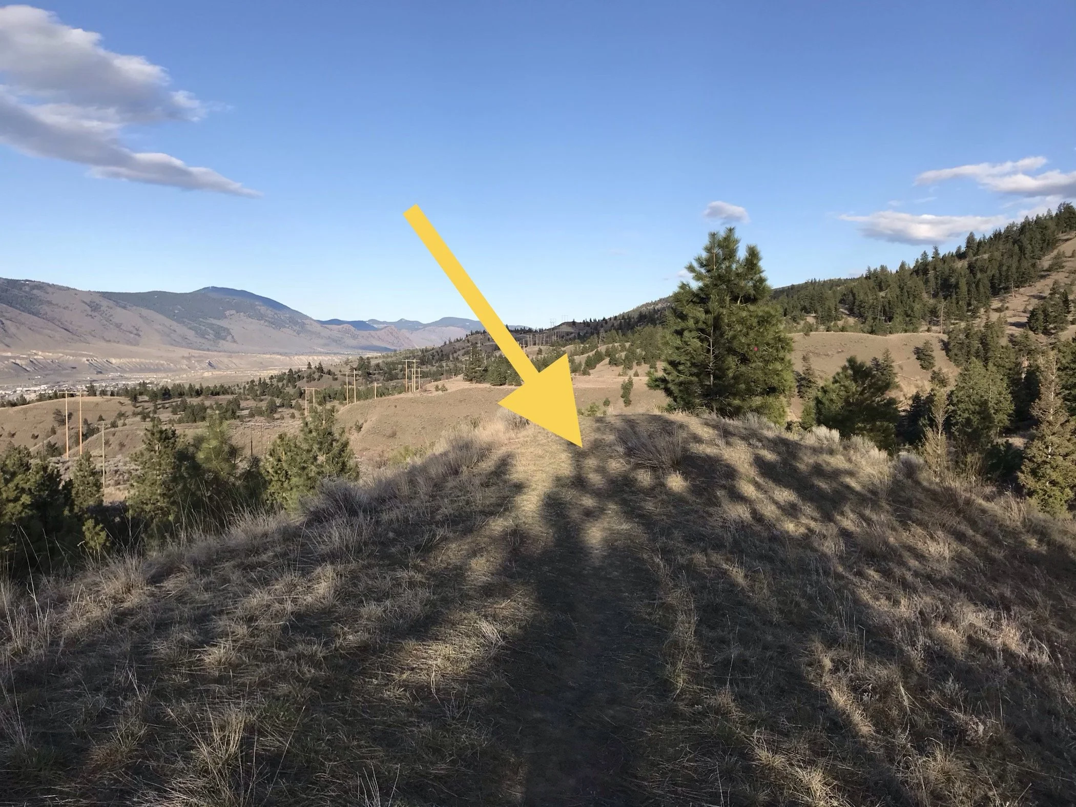
Photo 5 shows the location of the site. You can see that I have marked the precise location of the artifact with an arrow. For brevity I only included one image, but when you are doing this, feel free to take as many as needed to effectively show the context of the site.
Photo 6 shows the artifact in context where it as found. It is important to put a commonplace item in the image to provide a sense of scale.
Remember to leave the site as you found it. Assemble the photographs into an email, along with the name of who recorded the site, the date it was recorded, a short description of what was found, and a short description of where it is located.
Finally, send the email to archsiteform@gov.bc.ca. If you feel that the site may be under threat of imminent disturbance, please indicate that in the email header, and also cc it to archaeology@gov.bc.ca.
Congratulations, you have taken in important step on the road to citizen archaeology!