

How do you protect archaeological sites during a wildfire? With a whole lot of communication, cooperation, field maps, fire guards and luck!
On June 28, 2021, a human caused fire was started northwest of Kamloops near Sparks Lake. Within several days the fire was completely out of control and threatening many homes and properties. The Skeetchestn Indian Reserve was forced to evacuate the evening of July 2nd. The Sparks Lake fire has now burned over 90, 000 hectares, making it the largest wildfire in BC this year to date.
At Skeetchestn Natural Resources, the other archaeologists and I have been working in partnership with our own firefighting crews, BC Wildfire Service, Indigenous Knowledge Keepers, and foresters to help plan firefighting logistics. While life and property always come first, we do what we can to protect the cultural heritage in Skeetchestn traditional territory. Most archaeological sites in Skeetchestn territory are underground and are therefore, largely protected from the devastation of wildfire. Once a wildfire has burned over a site, the loss of the organic layer of soil and soil stabilizing roots can lead to archaeological sites being lost to erosion.
As fighting wildfires is an emergency, First Nation communities and archaeologists are often required to triage which archaeological sites are the most important to protect. Sites that are at the forefront to safeguard are typically significant places such as village sites, and places that contain ancestral burials.
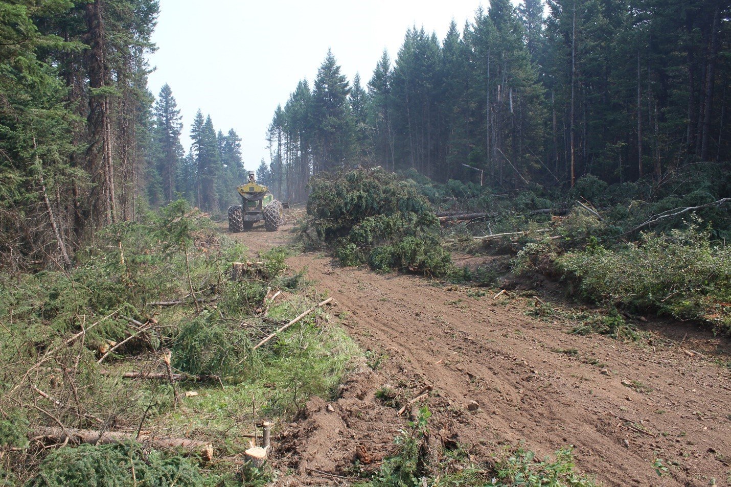
In our area, the predominant danger to archaeological sites during a wildfire is from the heavy equipment used to fight it. One of the most used and successful modes of controlling wildfires are containment lines, or fire guards. To create fire guards, heavy equipment removes the fuel – trees, shrubs, and all flammable material – in large swaths. Digging up the earth may help harness a wildfire, but it can also easily destroy archaeological sites!
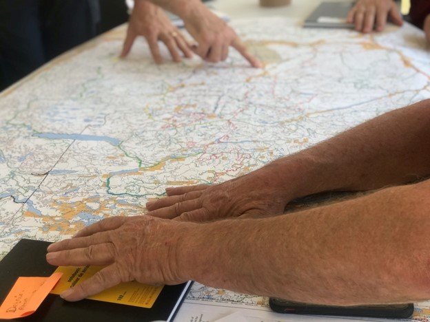
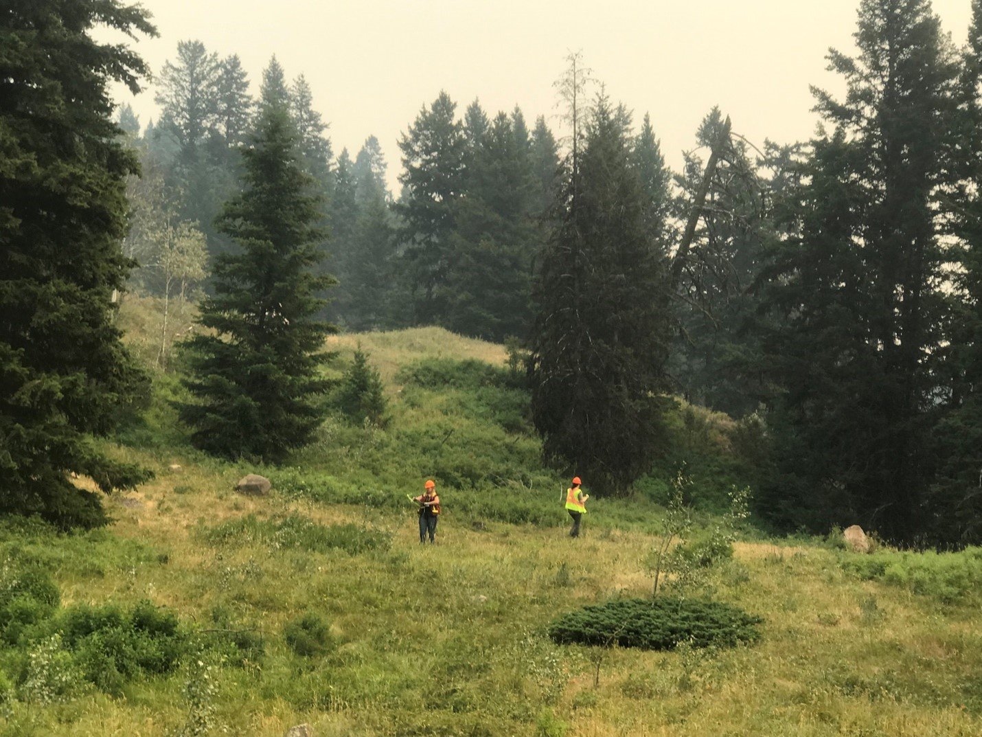
This is where having a database of known archaeological sites is incredibly important. In BC, the provincial heritage register, maintained by the BC Archaeology Branch, hold this data. Our GIS technicians create maps showing all the documented archaeological sites in an area, which helps us in assisting the planning of new roads, fire guards, staging areas, and firefighter safe zones. We meet daily with firefighting teams to review maps of where potential fire guards are going to be located. This is called line locating. If the guards are going to intersect with sites, we work on finding ways of placing them around the site or move them to bypass the site. Once a plan is in place of where guards are going to go, we head out into the field and flag archaeological sites that are nearby to remind heavy equipment crews of areas to avoid.
We are happy that after a month of being evacuated, the Skeetchestn community returned home in early August. However, our crew continues to work on the Sparks Lake and Tremont Creek fires. Between the Elephant Hill Fire in 2017 and the current fires burning, more than 45% of Skeetchestn territory has burned. Once the fires are out, we will begin the work of post impact assessments. This includes walking the fire guards, checking for undocumented archaeological sites, as well as reclamation work to protect sites that the fires went through. A bonus for archaeologists is that after a wildfire has removed the vegetation, it is often quite easy to find artifacts and features such as pit houses that have been hidden by plant life. Many of the sites in this area have survived for thousands of years and many burning events. It is our job as archaeologists to make sure that we not only learn from the archaeology in the area but also protect these areas for future generations.