

There have been several Dig It articles discussing aspects of the importance of context in archaeology, including the general location of sites and the stratigraphic layers that make up sites.
I am going to use a site from northeast British Columbia as an example of how having the location, artifact assemblage, and the vertical and horizontal contexts to help interpret the story of a site, and how losing that context makes it very difficult to tell what happened there.
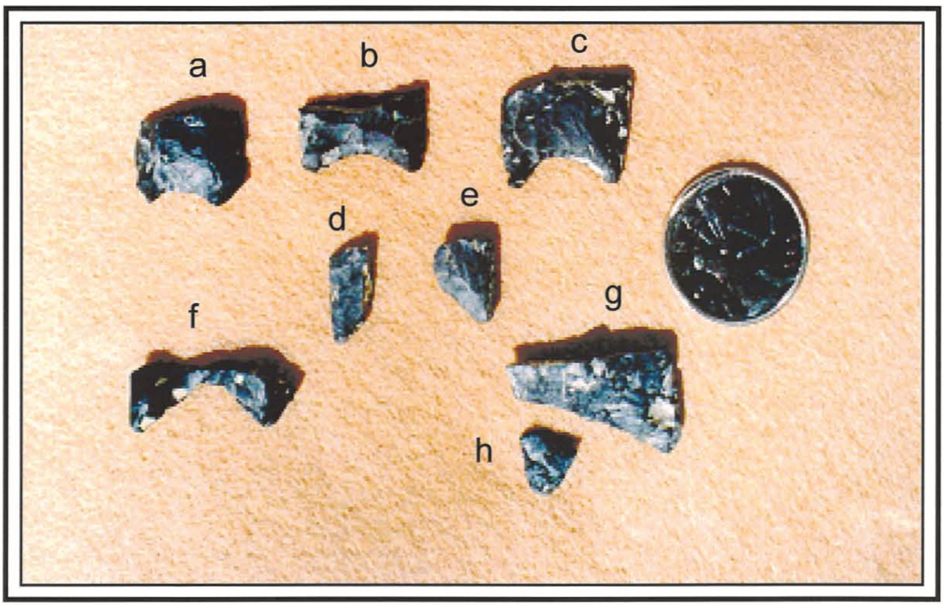
Imagine a development took place where all the sediment within an archaeological site was dug up and put in a big pile without archaeological work being completed first. After the fact, an archaeology team came in and screened the sediment pile. Over 700 artifacts were found, mostly debitage (the flakes resulting from stone tool production), a small number of unifaces (sharpened like a chisel) and bifaces (sharpened like a knife), 5 complete and 3 partial projectile point bases, and 5 sandstone cobbles, some with wear markings. From this, we know that the site is located, on a gentle east facing slope next to water, the artifacts suggest this is probably a hunting site, and, based on the shape of the projectile point bases, at least part of the site might be well over 6000 years old.
We can’t say how the artifacts are related to each other in time and space. Did they all come from one layer, perhaps suggesting a single occupation? Were they in several layers, suggesting people had repeatedly visited this site? Similarly, were they in one small dense cluster, or were they spread throughout the dug-up site area? Were there any features such as a campfire hearth? We will never know!
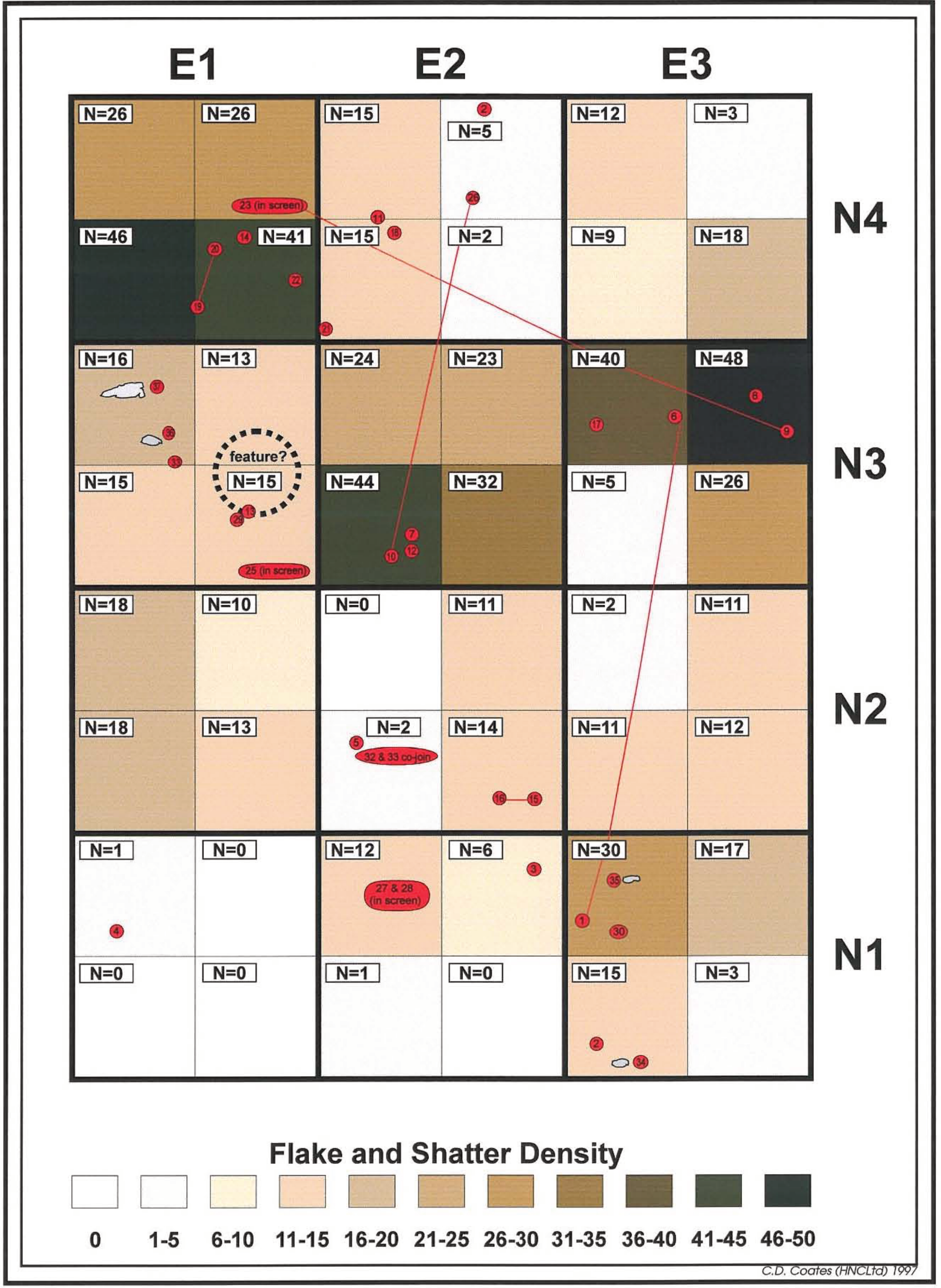
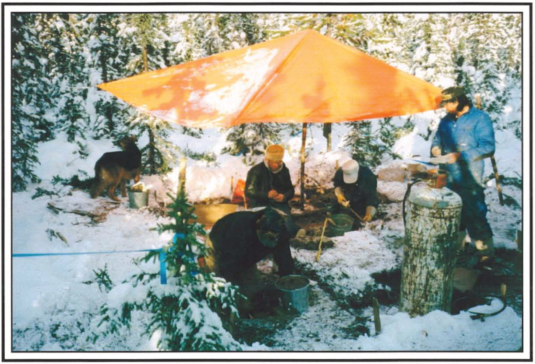
Instead, let us say that an archaeology team was able to conduct a controlled excavation in advance of the construction work. In this example, a 4 m x 3 m grid was excavated over the site. Following the excavation, the amount of debitage from the quadrants of each unit was calculated and placed on the site map, along with the location of other artifacts.
Several things became apparent:
- The vast majority of the artifacts were recovered from a single, shallow layer;
- A possible hearth was noted in the northwest part of the excavation block, with the sandstone cobbles found in proximity;
- There are three patches of relatively dense artifacts to the north and east of the hearth;
- Several artifact fragments from a few meters apart were found to “refit” back together into partial artifacts;
- Almost all of the debitage flakes are under 2 cm in size, with over half being under 10 cm; and
- Other than the cobbles, no complete artifacts were found.
With this information, we can now start to create a more complete picture of the site. The dense clustering of debitage near the hearth, the relatively thin layer where most of the artifacts were found, and the refit artifacts from across the site, suggest that it may have been created during a single short occupation instead of multiple visits over many years.
The small size and frequency of debitage is consistent with the last stages of tool making and maintenance. The wear marks on the sandstone cobbles could be the result of platform grinding to increase the reliability of the flaking process.
Putting it all together, we can now tell a more complete story about the site. A small group of hunters from at least 6000 years ago came to the location to camp for a short time and rejuvenate their hunting equipment. The broken point bases attached to the spear thrower shafts were being cut off and replaced with newly made points, and they were possibly processing the meat and/or hides.
So as you can see from the two examples discussed here, much context is lost when an archaeological site is disturbed before investigations take place, and that data is lost forever. Which is why it’s always so important to ‘call before you dig’!