
When many people think of archaeology, they think of large excavations and activities which involve the ground – digging, trowelling, and uncovering history below us. In British Columbia, a lot of archaeology that is done is a result of industry, and one industry which many archaeologists work in is forestry.
When a forestry company has blocks they plan to harvest, one of the steps they must take before they can begin is to involve cultural heritage organizations. Crews usually consist of an archaeologist and members of local First Nations. Maps will be acquired, archaeologists will do background research to find registered sites in the area of work, if present, and make a plan. Then the crew will visit the blocks and do ground survey.
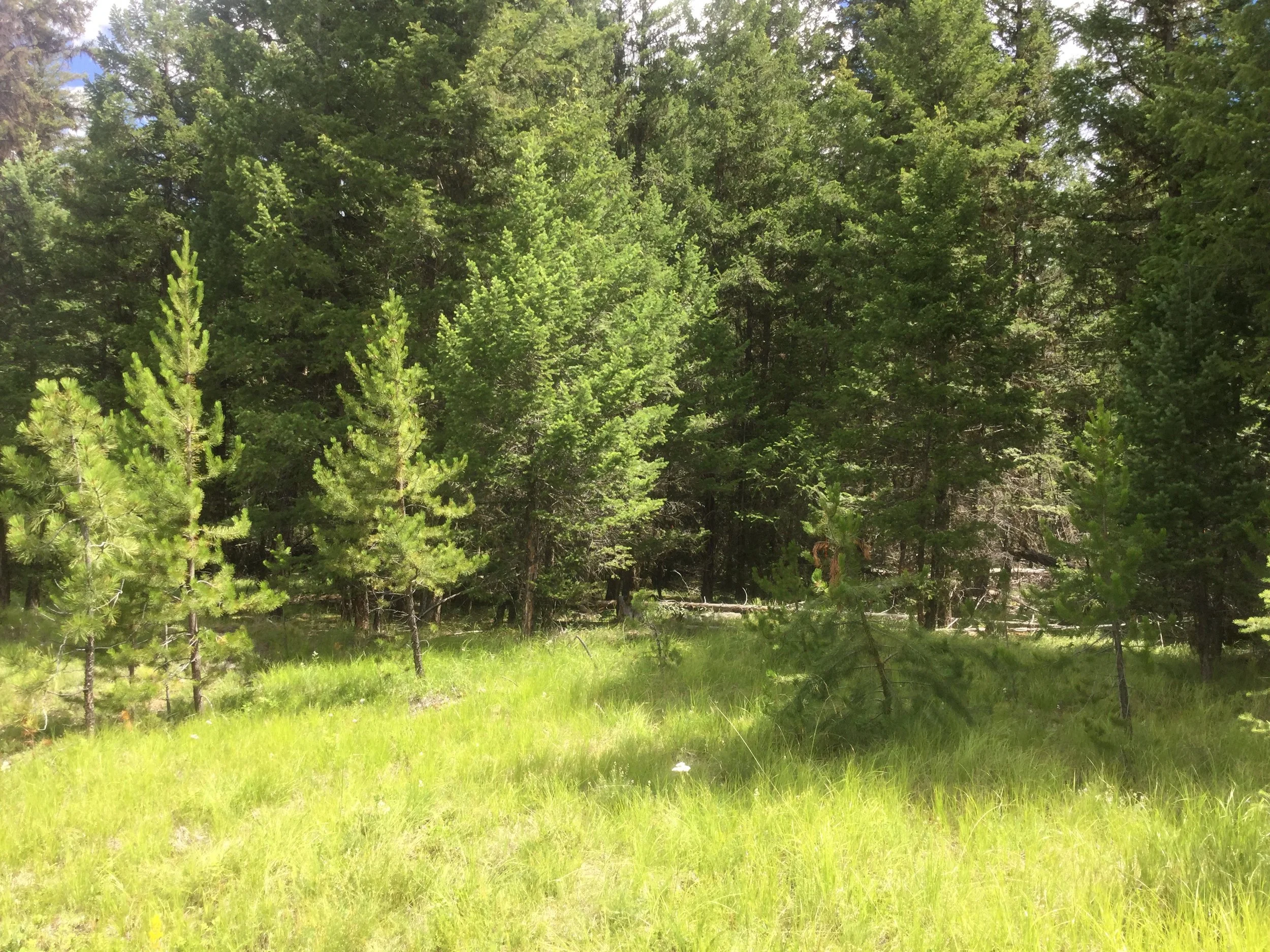
This is called a preliminary field reconnaissance, or PFR. This entails crew members walking the cut block in transects of specific, but variable, distances, depending on the requirements or desires of the organization. Sometimes the blocks have been previously harvested, and are easy, casual walks in the forest. Other times, the blocks have heavy deadfall due to beetle infestation killing trees, poor forest management, or many other reasons. Forestry work involves hiking many kilometers a day, in remote areas with obstacles such as wildlife, danger trees, and old forest service roads no longer passable.
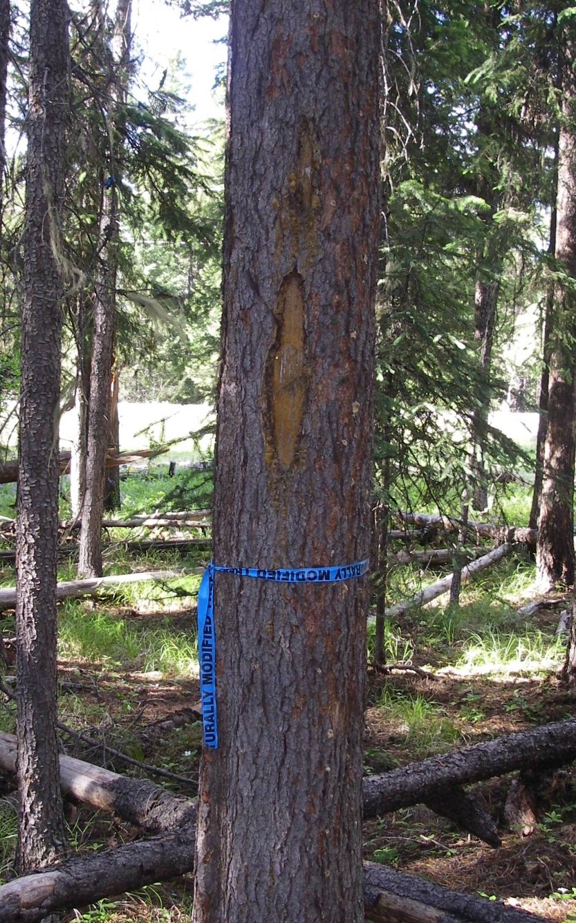
While in the forest, the crew is looking for culturally modified trees, or CMTs. They can be trees with various stages of scarring left from the past when indigenous peoples would cut into them for a variety of reasons- marking trails or harvesting bark for example. In the interior, old growth trees have mostly been harvested, and therefore unfortunately so have many of the CMTs. According to the Heritage Conservation Act, CMTs must be culturally modified before 1846 to be deemed protected. There are various methods used to try to deduce the age of the tree and time of modification; using an increment borer can give the archaeologist an accurate age.
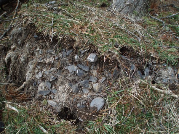
The crew is also looking for surface artifacts (which are exciting but can be rare to find on the forest floor due to a lack of surface exposure), cultural depressions, or landforms with archaeological potential. Cultural depressions can identify a house pit, cache pit, or fire pit, depending on the shape and features of the depression. Landforms of archaeological potential can be anything from breaks in slope where someone would like to sit and work on a stone tool while hiking, to a low-lying terrace beside a creek to spend time fishing and having a fire, to a high ridge with rocky outcrops to watch over the valley looking for animals to hunt.
The crew will identify the areas or trees within the cut block deemed to have archaeological significance, and will generally recommend avoidance as the method of mitigation. In many cases, the forest company will exclude those areas from the final harvest plan. If they chose not to, they would need to obtain a Heritage Conservation Act permit to then assess the areas with an archaeological impact assessment to identify and evaluate sites.
Hiking through the forests can be a fun way to spend the workday, imagining how the land may have been used in the past and finding clues to point us there. If you are ever hiking in the forest, and you see an artifact lying on the trail, leave it where it is. Take a location identifier and contact the archaeology branch – you may have just discovered a new site!