

Approximately 2,400 years ago, Mount Meager, in the Southern Interior of British Columbia, erupted.
The eruption launched a plume of ash that was deposited on lands up to 530 kilometres to the east, in southern Alberta.
Directly downwind of the eruption is the Bridge River, from which the massive deposits of ash get its name — Bridge River ash.
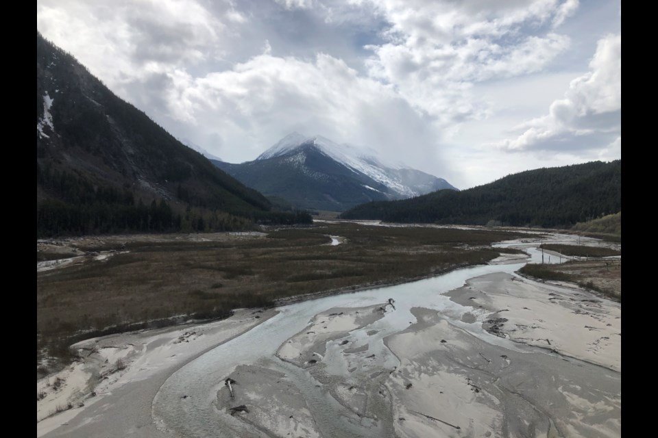
More recently, the landscape of the upper Bridge River is one that has been modified by modern dams, impounding the Bridge River in two reservoirs.
During the last five years, St’át’imc Government Services has conducted archaeological survey work in the upper Bridge River, looking for archaeological sites both above and below the deep layer of ash deposited by this eruption.
The landscape we’ve encountered is both breathtakingly beautiful and a reminder of the destruction that occurs with a massive volcanic
eruption.
When Mount Meager erupted, it left a thick layer of ash in the Bridge River valley, likely killing much of the forests and animals in its path.
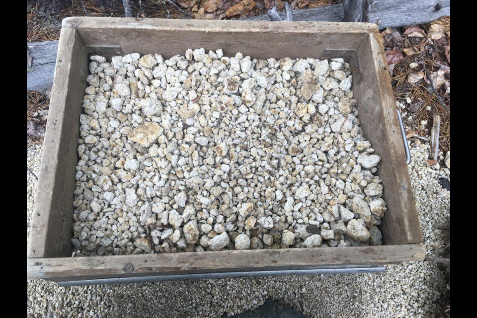
The river is full of volcanic tephra, both in a talcum-like powder form and popcorn- to fist-sized chunks of pumice. Eroded hillsides show rivers
of ash.
Reservoir archaeology can be fascinating.
When you remove all the normal impediments to finding archaeological sites, like forest littermats, soils and surface sediments, artifacts can be found on the surface.
Due to the land exposure in reservoirs, we don’t necessarily need to dig to find buried artifacts, which can be time-consuming and provide only a narrow glimpse into what is present beneath the surface.
The sites are out of context and disturbed, but we tend to find more than we would if we depended on the usual subsurface testing.
However, when the landscape is covered in volcanic ash and silts are drained from a massive glacier, things get a bit trickier.
Subsurface testing adjacent to the Bridge River in forested settings has shown that up to a metre of ash is present beneath the forest floor.
When we’ve excavated shovel tests in these contexts, we’re digging to the depth of our shovels and scooping out bucket-fulls of ash.
Again, you have to picture what it would have been like to be in this river valley when the eruption occurred — scary and, most likely, deadly.
Despite the thick deposits of ash, we are finding abundant archaeology.
Due to the modified landscape and the thick blankets of ash, we aren’t certain if any of the archaeological sites we have identified pre-date the
Mount Meager eruption, but it is clear the upper Bridge River was (and still is) well used by St’át’imc peoples.
Archaeological sites composed of stone artifacts and tools are present on alluvial fans and slopes bounding the Bridge River and we can assume this has always been true.
We’re hopeful to find dateable artifacts and to develop the means to test below the thick layer of ash more effectively, but it seems certain that St’át’imc peoples utilized the resources in this river valley.
Since the volcanic eruption, the Bridge River valley has rebounded with lush, high elevation forests and abundant wildlife.
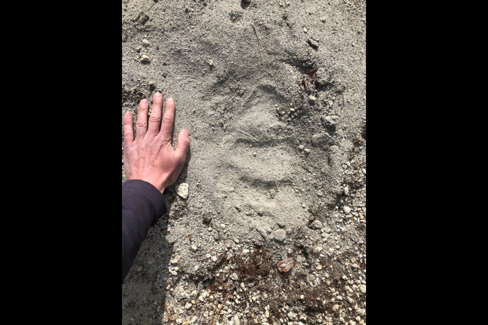
Footprints in the ash show a thriving grizzly and black bear populations, as well as wolves, deer and moose.
Fish are present in the river and eagles are perched above the river looking for these fish.
While this river valley faced a natural disaster and modern impacts from dam construction, it’s clear from the archaeology in the upper Bridge
River valley that St’át’imc peoples were adaptable to changing environmental conditions and have much to teach during our continuing climate changes.
Alysha Edwards is a St’át’imc archaeologist and graduate student at the University of Montana. Matt Begg is an archaeologist based
in Kamloops.