Looking into the past to cultivate a food of the future

If you’ve been looking out over the hills since the snow melted this spring, you’ve probably noticed the bright yellow balsamroot dotting hillsides. That sunflower has been a food and medicine staple for Interior peoples for thousands of years.

Called tséts̓elq in Secwepemctsin (Balsamorhiza sagittata in science), balsamroot’s big vitamin-rich taproot made it an important food and trade item. In our world of refined flours and sugars, it’s hard to imagine carbohydrates being sparse. But before contact, they were hard to come by here, and tubers like balsamroot mattered a lot.

In archaeological sites, we find artifacts and features associated with the harvest, storage and processing of balsamroot and other tubers and bulbs, signaling their importance over the millennia.

Elk antler digging stick handle.JPG

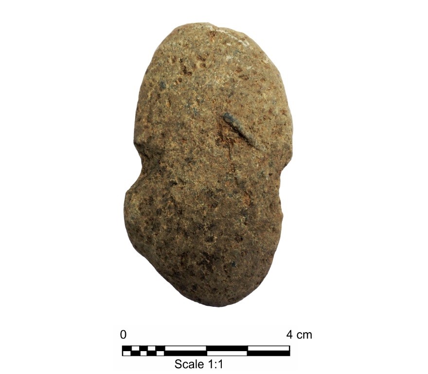
Root digging, traditionally women’s labour, was done with waist-high digging sticks on wood or antler handles, many of which endure in archaeological sites. Some are exquisitely decorated with incised patterns that potentially reflect keeping counts. Small, expedient stone knives used to top and trim the roots are found in quantity at long-term intensive balsamroot harvest locations.

Balsamroot is amenable to long-term cold storage in earth cache pits, which we find across the landscape, but in particular concentrations near the winter villages where people could dip into a nutritious root supply throughout the cold months.

balsamroot root portion.jpg

The root is cooked by baking in earth ovens, piled atop layers of red-hot rocks and moist leafy veg, then the whole works buried for a long, slow roast. Once emptied of cooked food, these ovens slump into cracked rock and charcoal-filled depressions that provide archaeologists with clues about food preparation practices.

Once cooked, the root is eaten, but can also be dried and pounded into a nutritious flour that stores well and can be added to foods throughout the year. Residue analysis finds that pounding implements like mortars and pestles can retain the microscopic starchy granules from the plant for hundreds or thousands of years.

Charcoal stained roasting feature at an archaeological site near Sun Rivers.JPG

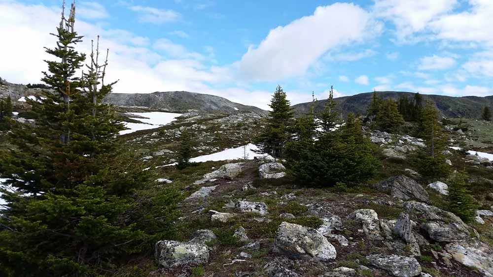
In our area, recent archaeology in Lac Du Bois Grasslands has identified clusters of large earth ovens that could hold held several hundred pounds of roots at a time. The labour and fuel required for this is opening our eyes to the scale of food production undertaken here in precolonial times. In the Botanie Valley near Lytton, similar archaeological sites dot the landscape that is to this day an important food gathering area.

Digging balsamroot wasn’t just to get a quick bite, it was also planning for the future. Root gathering places that have been tended for generation upon generation are made abundant through aeration, selective harvest and regenerative burning. As an annual spring activity, tending balsam patches ensures families get enough carbohydrates for this year, plus ample and productive plants for years to come.

Since contact, these Indigenous cultivation practices have been dismissed and discouraged by settlers, and paired with degradation of grassland ecosystems by cattle and invasive species, balsamroot communities are in decline.

With more mindful land management practices, and revival of traditional cultivation, balsamroot may yet become a food of the future, from the past.

Recording history one shovel test at a time

For archaeologists in the southern interior, the summer months commonly involve spending long days digging shovel test after shovel test. Shovel tests are used as a technique to discover archaeology sites buried in the ground and involve archaeology crews manually digging square holes measuring 35 cm a side and 70 cm deep. All of the dirt removed from the test is sifted through a mesh screen to catch any artifacts that may be buried in the ground in that location. More often than not, shovel tests are dug and no artifacts are found within the sifted dirt. Archaeologists call these negative shovel tests.

shovel test.JPG

Occasionally shovel tests are placed in just the right location and we find artifacts in the tests. When this happens, it feels like everyone’s hard work stomping on shovels and carefully sifting through the dirt is rewarded. Finding even one artifact, which in the southern interior typically consists of stone tools or the stone chips associated with making stone tools, constitutes an archaeological site. Archaeological sites are afforded automatic protection under the Heritage Conservation Act.

As soon as an artifact is found, there are specific tasks that must take place so that the newly identified archaeology site is adequately tested and recorded. Since the details and location of each archaeological site are unique, archaeologists must determine how many shovel tests are required to appropriately test the site in order to comply with archaeological permits issued by the Provincial Archaeology Branch or First Nations organizations (or both). This typically involves digging shovel tests at specified intervals, usually every 2 to 5 meters away from the test containing artifacts, until there are two or three negative shovel tests in a row in every direction. Depending on how many shovel tests contain artifacts, this process can add dozens of additional shovel tests for archaeology crews to excavate. The idea is to find the extent of the buried artifact scatter and determine the outside boundaries of the site.

Once the testing is complete, a site map is drawn to depict the location of all of the shovel tests in relation to nearby landmarks, like creeks or roads.  The subtle details in the topography surrounding the site are also drawn, such as landform margins, changes in slope, and bedrock exposures. There are all sorts of global positioning technologies to assist with site mapping, but archaeologists commonly just use graph paper, a compass, and measuring tape to create an accurate and to-scale map.  

archaeologist drawing an archaeology site map.jpg

These completed site maps are then provided to the Archaeology Branch so that the location of the newly identified site is added to the central database called the Provincial Heritage Register. This means that any archaeologist working in the area in the future will have access to the map, which will help inform them about the type of terrain where one would expect to find an archaeological site and provide insights into how the landscape was used thousands of years ago.

site map example.JPG

Finding new archaeological sites and uncovering artifacts that haven’t been touched for thousands of years since they were disposed of or lost is partly what makes archaeological field work so exciting. Documenting archaeological sites through accurate site mapping and recording ensures that information about each archaeological site in the province is preserved.

Wear and tear can tell the tale of a tool

Stone tools and the waste flakes produced from their manufacture and use are the most common archeological artifact found across the globe.

Through the analysis of stone artifacts, archeologists are able to make inferences regarding various aspects of past human behaviour, such as where and when people resided on the landscape, long-distance trade, technological organization, artifact style, form and, importantly, function.

When concerned with questions of stone-tool function, archeologists employ a range of techniques referred to as use-wear analysis.

Much like toolmark analysis in forensic sciences, use-wear analysis attempts to document and compare indicators of wear on stone tools that are related to the specific materials that were worked — and the manner in which these items were processed.

There are two approaches to use-wear analysis based on the type of microscopes used in the study. They focus on different, but related types of edge wear.

The low-power approach to use-wear analysis utilizes common everyday laboratory microscopes ranging between 10-times to 100-times magnification to document the nature, location and abundance of microfracturing along the working edge (photo 1).

The use wear shown on the artifact in photo 1 suggests this stone tool was used to scrape wood.

The high-power approach uses much more sophisticated microscopy that can attain magnifications of 200 times and greater, thus allowing for observations of abrasive polishes and striations on the working surface of a tool (photo 2).

This polishing and the abrasions suggest this stone tool was used for working animal hides.

PHOTO: The low power approach to use-wear analysis utilizes common everyday laboratory microscopes ranging between 10-times to 100-times magnification to document the nature, 
location and abundance of microfracturing along the working edge. - Ryan Dickie

PHOTO: The high-power approach uses much more sophisticated microscopy that can attain magnifications of 200 times and greater, thus allowing for observations of abrasive polishes and striations on the working surface of a tool.Ryan Dickie

Most functional analyses rely on experimentation on the effects of tool use on various materials in order to replicate the wear traces found on ancient stone tools.

Using different types of microscopy and levels of magnification, the analyst compares the experimental wear patterns with the archeological specimens, which allows for interpretations of tool function to be made.

The insights derived from understanding stone-tool function allow for further inferences to be made about the occupation of the site based on the activities represented in the assemblage of utilized stone tools.

Perhaps the most important aspect of any use-wear analysis is building a representative reference collection of experimental stone tools. The goal is to re-create as wide of a range as possible of potential wear traces that may be present in an archeological collection of tools.

This step involves procuring the right stone for the experiments, creating the collection of tools for the experiments and using the experimental assemblage for a range of tasks that may be reflected at a particular site, such as fish or deer processing, plant gathering or woodworking.

When supported by good experimental research, use-wear analysis of stone tools can provide valuable insight into past human behaviour and shed light on the fundamental question of how people used their various technologies.

With so much of the record of past cultures lost to natural organic decomposition, fragmentary stone tools are often all that remain for archeologists to tease out the nuances of everyday past life.

Use-wear analysis can help bridge the divide between the past and present by providing direct insight into what people were doing on the landscape and with what materials.

Dating, relatively speaking

As an archaeologist, the question I am probably most often asked is ‘what’s the coolest thing you’ve ever found?’.  It’s generally seconded by ‘what’s the oldest thing you’ve ever found?’.   Hardly ever though, am I asked ‘how did you determine how old that is?’ , which can be a far more interesting question!

While there are several ways to potentially glean the age of artifacts or features from archaeological sties, they generally fall into one of two categories; absolute or relative dating.

Absolute dating includes those methods that provide a date, or range of dates, for an item or feature.  Such methods include radiocarbon dating (measuring the amount of carbon 14 left in an organic item), dendrochronology (counting tree rings), or thermoluminescence (measuring ionizing radiations that naturally occur in the atmosphere).

Relative dating includes methods that provide a chronology of ‘earlier’ and ‘later’, although not necessarily specific date ranges, based on their locations respective to each other.  Using laws of stratigraphy for example, we know that in an undisturbed context, the lowest layers of sediment (and any artifacts associated with them) are always older than those layers of sediment (and artifacts…) laid down atop of them, even if we may not know their numeric age.

Using artifact typology however, we can start to assign date ranges, if not specific dates, to artifacts or features that may be otherwise un-datable due to a lack of organic matter.  Using typology, we classify artifacts by their physical similarities and begin to link those to specific periods, or ‘phases’ and ‘horizons’.  Once archaeologists have consistently found a specific style of artifact associated with enough archaeological materials that have been dated ‘absolutely’, we can confidently state that style of artifact belongs to a specific phase, even if we are only able to provide a ‘relative’ context where they were encountered.

In our local area, the most recent chapter in the archaeological sequence has been broken down into a series of periods, or horizons; according to Richards and Rousseau (1987), these horizons ‘comprise the Plateau Pithouse tradition, a cultural tradition characterized by semi-sedentary, pithouse dwelling, hunter-gatherer, logistically organized, band-level societies that relied heavily on anadromous fish for subsistence’. 

These horizons are referred to as Shuswap, Plateau, and Kamloops respectively, and each have several discrete traits that appear in archaeological sites associated with them.  Included in these traits are specific styles of projectile points, which is a blanket term that includes stone points used with the spear, atl atl, and bow and arrow technologies that First Nations utilized at the time.  It is these artifacts that we call diagnostics, meaning we can use the concept of artifact typology to provide an estimate of age for sites in which we find them.

The Shuswap Horizon is estimated to have begun between 3500-4000 years before present and ended approximately 2400 years before present.  While projectile points from this period show a relatively high degree of variability, they tend to be on the larger side, and have a neck width that is indicative of use with spear, or atl atl technology.  They also tend to have concave bases, are triangular or lanceolate shaped with shallow notches in the corners or lower sides, and have pronounced shoulders.

Shuswap horizon projectile points

Shuswap horizon projectile points

The Plateau Horizon extends from 2400-1200 years before present, and ‘Plateau points’ are most always bilaterally barbed with either comer- or basal -notches.  They range in size from large to small; appropriate for tipping spear and atlatl darts or arrows.  The larger points, used for spears and atl atls, appear in the archaeological record in the earlier portion of this horizon.  After 1500-1700 years before present the smaller points, more appropriate for bow and arrow technology, begin appearing.

Plateau horizon projectile points

Plateau horizon projectile points

The Kamloops Horizon extends from 2400 years before present, to 200 years, where technology and behaviour patterns changed again as a result of contact with European colonizers.  ‘Kamloops points’ are small and very triangular in shape, with narrow notches along each side and straight to slightly concave bases – best used for bow and arrows. 

From this example you can begin to see that with a lucky projectile point find, and a bit of detective work, we can actually start attributing date ranges to an archaeological site even if we don’t encounter archaeological materials or artifacts that could be dated absolutely.  I encourage you to head down to our local Secwepemc Museum to view the wonderful collection of items they have on display, and see if you can recognize how old some of them are from the descriptions and attached photos – consider it the first lesson in dating, relatively speaking!

Kamloops horizon projectile points

Kamloops horizon projectile points

Bridging the Past

The canyons, chasms, and gullies that carve up this province have always made this landscape a challenging one to travel through. Precolonial Indigenous engineers devised some pretty neat ways to span rivers that were often not navigable by boat. Come along for a picture tour of these amazing structures!

Without milled lumber, cement or steel, before giant drills and pile drivers, Indigenous people engineered spans as long as 150 feet across, hanging 50 feet above the swift and turbulent rivers below.

Bridge over the Cranberry (Salmon) River 1905, BC Archives item AA-00168

Bridge over the Cranberry (Salmon) River 1905, BC Archives item AA-00168

This bridge over the Cranberry (Salmon) River was made by bending and tying poles with cedar withes (thin, flexible branches), looking a lot like in-stream fish traps that people built with the same materials.

Suskwa River Bridge late 1800s, BC Archives item NA-20442

Suskwa River Bridge late 1800s, BC Archives item NA-20442

Some bridge construction will look more familiar, with short cross timbers. This one, on the Suskwa River near Hazelton, was reinforced with telegraph wire in late 1800s, at the request of traders and settlers wanting to take pack animals across.

Most bridges were built using the same ideas behind massive modern suspension bridges: balance and tension. Cantilevered spans fastened with withes, rope and wooden pegs were weighted with rock and log ballast.

Hagwilget Bridge 1872 BC Archives item 06048

Hagwilget Bridge 1872 BC Archives item 06048

Probably the most famous span is the Hagwilget Bridge, which crossed the Bulkley River near Hazelton. A marvel of imagination that continually changed as timbers were replaced, the Hagwilget bridge both impressed and terrified the white men who used it. In 1919 Charles Morison wrote: “it was really a wonderful piece of work! but shaky and calculated to try the nerves of anyone crossing it for the first time”.

Hagwilget Bridge 1890s BC Archives item a_00783

Hagwilget Bridge 1890s BC Archives item a_00783

By the 1890s a deck had been added to Hagwilget Bridge. By 1910 it had been reinforced with telegraph wire. By the 1920s settlers tried to replace the whole thing with the new one in the distance. But it was a difficult place to span, and it swayed so much it wasn't that popular!

Second and third bridges at Hagwilget 1920s BC Archives item a_04014

Second and third bridges at Hagwilget 1920s BC Archives item a_04014

The bridge at Moricetown, 1905, was sturdy enough for livestock to cross, one of the major motivations behind using plank decking.

Bridge at Moricetown 1905 BC Archives item e_08398

Bridge at Moricetown 1905 BC Archives item e_08398

There were likely hundreds of these ingenious bridges around BC, constructed and maintained in strategic locations over the millennia. Little more than a few splinters and rotted logs remain, along with these invaluable photos. To learn more, visit the Royal BC Museum’s website (royalbcmuseum.bc.ca/exhibits/living-landscapes/northwest/bridges) or just search BC Archives’ excellent online catalogue of pictures and documents.

After the ice age: The First Peoples in the Kamloops area?

Dig It is KTW's regularly published column on the history beneath our feet in the Kamloops region. A group of nine professional archeologists living and working in the area contribute columns to educate and fascinate. From writing about specific sites to the life of an archeologist, the columns uncover the complex past of the land on which we walk in the present. To read previous columns, go online to kamloopsthisweek.com and search "Dig It."

By Ramsay McKee republicofarchaeology.ca

During the last ice age, called the Fraser Glaciation, the Kamloops area was buried under up to two kilometres of ice.

About 13,000 years ago, the ice sheet covering western North America (called the Cordilleran Ice Sheet) began to melt. By this time, people were already living in ice-free regions of Alaska and the Yukon, along the west coast of B.C. and south of the ice sheets in the continental U.S.

As the ice receded, the meltwater pooled into very large glacial lakes covering all of present-day downtown Kamloops, Pritchard, Chase and beyond, dammed by large masses of ice at its east and west ends.

The first plant communities to develop in this cold, barren landscape resembled a steppe tundra -- vast tracts of grasses and low shrubs with occasional groups of small trees in low-lying and sheltered areas. The first animals, including birds, rodents, rabbits, deer, elk, mammoth and their predators, soon followed.

Who were the first people to come to this landscape? From where did they come?

The earliest evidence of people arriving in the Kamloops area comes from stone tools they left behind. In particular, early projectile points and blade technologies that closely resemble the stone-tool technologies of people who lived on the B.C. coast, the Far North, the continental U.S. and the Great Plains have all been found in the region.

Unfortunately, these artifacts have mostly been observed in local museums and private collections, which means the context in which these finds were made has been lost. Very few archeological sites that can provide more insight into who the earliest inhabitants of this region were have been discovered to date.

Given that so few early sites have been found, our understanding of who these people were and how they lived largely remains a mystery. Based on what little information is available, the best hypothesis is that early human populations gradually made their way into the region from the south, from the B.C. coast, from the north and from the west as plants and animals they depended on began to colonize the region.

The first peoples in the region are thought to have been accomplished hunters of large game, supplementing their diets with smaller animals, birds, plants and aquatic resources. These early groups were highly mobile, following the seasonal round of their preferred game animals and the ripening of plant foods.

The recent discovery and intense study of an ancient mastodon-butchering site in Northern California that has been dated to about 130,000 years old, before the last ice age, leaves many archeologists with more questions than answers.

If there were people in California 130,000 years ago, could they have been in the Thompson Valley? Were these anatomically modern people like us, Neanderthals or another human species entirely? If there were people here that long ago, what happened to them?

Answering these questions is neither a quick nor an easy process -- and we may never be able to learn the whole answer.

What do archaeologists do in the winter?

As an archaeologist, I often get asked about what I do in the winter. I would like to say my winters consist of spending weeks on tropical sandy beaches to even out the glove tan from the summer, but the winter is often a busy time of year. Snow and frozen ground generally stop archaeological field work for the year (not always, but I won’t get into that here). Although the winter season offers relief from long hours of digging shovel tests and sifting dirt, there are specific tasks that archaeologists must complete in the winter months prior to the start of the next field season.

During the winter months archaeologists are kept busy writing reports and summarizing the data collected during the field season in order to present project results and recommendations to local communities and clients. Providing summary reports is also a requirement to fulfill archaeological permit obligations to the Provincial Government and First Nations.

Additionally, specific forms must be filled out to document the location and provide information about any new archaeological sites discovered. These forms and associated mapping information are kept in a database regulated and maintained by the BC Archaeology Branch. There are well over 45,000 archaeological sites currently recorded in BC and this number continues to rise annually. It’s important that archaeologists document and report the locations of newly discovered archaeological sites in a timely fashion so that the database is current and accurate.

Depending on the type of project undertaken in the summer, archaeologists are often left with many stone artifacts and faunal (animal) remains to inventory and analyse over the winter. The stone and bone artifacts are classified and studied prior to submitting the items to an approved museum (another archaeological permit requirement). Commonly, the debris from stone tool manufacture makes up the bulk of the artifacts recovered during a field program. Formed tools, such as spear points or arrowheads, are found more rarely. Although classifying hundreds or even thousands of small stone chips may sound like a mind-numbing task, we can learn a lot from the waste left behind from making tools.

There are many different ways to categorize lithic artifacts but typically the size of the item, the stone material type (is the artifact made of chert, basalt, or obsidian, for example), and certain characteristics present on the stone chip itself are used as basic ways to sort the artifacts. Previous installments of Dig It have explained what can be learned from analysing stone tools and stone chips (https://www.kamloopsthisweek.com/dig-analyzing-stories-past/; https://www.kamloopsthisweek.com/dig-stoned-souls/).

When archaeologists get to work collectively to catalogue the artifacts it can really enhance the process and make it much more enjoyable. I was recently cataloguing a few thousand stone artifacts with the field crew from a large project we had all worked on together in the summer.  As we were constantly opening bags and looking at different artifacts, the task never felt monotonous as there was always something new to look at and examine. Opening the dirty ziplock bags housing our finds from the summer caused us to fondly reminisce over the past field season. The information gathered through classifying the artifacts allowed us to really delve into what types of archaeological sites we were dealing with, the antiquity of the sites, and what types of activities occurred there.

Although the winter season comes with specific and time-sensitive tasks for archaeologists to complete, come spring you might see some of the local archaeologists eagerly awaiting the snow to melt to start the process all over again.

Context tells the story behind ancient artifacts

Archaeologists are story tellers that use (hopefully!) scientific methods to assist in chronicling past lives. Context is one of the most powerful tools at our disposal, and is a concept so basic that it is often overlooked. This installment of Dig It illustrates this idea using an example from the southern interior of BC. Future installments will delve deeper into aspects such as stratigraphy, stylistic dating and radiometric dating.

Weight 1.jpg

Imagine I have passed to you the object in the photo and asked you to discuss it. Upon examination, you see that it is a thin, flat, sedimentary rock, about 4 cm by 8 cm, with what appears to be two notches removed from the sides: hardly a ground-shaking discovery. The only real clue is that, since I am an archaeologist from the southern interior of BC, you think it might be something more than “just another rock.” In isolation, this object does not provide very much information to tie a story to. The story so far, “a little flat rock that might be an artifact” is hardly riveting, is it?

However, when we place this artifact in the context of other, similar looking ones found in archaeological sites around the southern interior, and combine it with information gleaned from ethnographic accounts and traditional First Nations knowledge, it looks like it might have been used to weigh down the bottom edge of fishing nets. Now we have the first beginnings of a story! Still, “someone, somewhere, at some time, might have used this rock for fishing,” is a rather bland tale.

We now add more layers of information about this artifact. It was found at an archaeological site overlooking a lake in the southern interior of BC where fish, including Kokanee salmon, lived. It was found in association with over forty very similar artifacts, all at about the same depth, scattered in a linear fashion for about 4 m, perhaps showing where a net was left hanging to dry. In this site very little fish bone was found, even though large amounts of deer bone were recovered, suggesting that bone preservation would be good. The only other obviously fishing-related artifact was a small antler harpoon point in the second photograph, recovered from a nearby archaeological site, also overlooking the lake.

Harpoon.jpg

Now, we are getting somewhere! We have the foundation of a pretty good story, but the question “where are all the fish?” still puzzles us. One of the great privileges that we, as archaeologists, have in Canada, is that we get to work within a complex web of knowledge regarding past lives that extends from living memory, far into the past. Tapping into this treasure of information (through research and talking to local First Nations community members), we find the final keys to the puzzle. First, this area is specifically known as a fishing location. Second, the local cultural practice was, and still is, to return the bones of fish back to the water once processed.

Though artifacts are interesting objects in and of themselves, when considered in isolation, they only take us a short way towards understanding the past. This is the underlying reason why it is so important to leave artifacts where they are observed. Without recording the context, archaeologists are not story tellers, merely treasure hunters.

Archaeological site types in Kamloops, and beyond

There are many types of archeological sites recorded around the world.  Most readers will likely be familiar with the largest and most famous examples, such as the Pyramids of Giza in Egypt, Stonehenge in England, Chichen Itza in Mexico, and Machu Picchu in Peru.  Though these are fascinating sites, and are well-marketed and well-travelled as a result, they are generally quite rare.  They also often represent special-use or sacred areas, and don’t necessarily reflect what the everyday life was like for an average person at the time.  While less-obvious sites might not be as impressive to the public, archaeologists tend to get excited about them as they provide valuable insights into the day-to-day activities of people’s lives in the past.  And to ‘us’ archaeologists, that’s what’s really exhilarating to learn about.

Cultural Depressions.jpg

While the combination and variety of archaeological sites in our local area varies, there are number of common site types we tend to see repeateldy.  This aim of this column is to provide a description of some of these sites, and how archaeologists know what they are when we find them.

Lithic scatters: stone tools are created through a process called flintknapping, and a surprising amount of lithic debris comes off the core rock during the flintknapping process.  The debris that’s left behind on the ground become lithic scatters. We rarely find archaeological sites in the regions without this lithic debris on or below the ground surface, often both.  These generally consist of tools, tool fragments, or sharp pieces of lithic ‘stone-chips’ observed on the ground surface, or eroding out of sub-surface ground exposures like cut-banks, or tree throws.

Faunal scatters: similar to lithic scatters, but are created from animal bone fragments instead.  These types of sites are usually created during butchering, processing, as part of cooking activities, or discarded after consumption.  They are usually expressed as weathered bone, or bone fragments, also observed on the ground surface, or eroding out subsurface exposures.

Cultural depressions: this is a ‘catch-all’ phrase used to describe what we see in archeological sites that represent a few types of features.  Larger depressions are often collapsed semi-subterranean pit houses, or house pits; this is what remains of the homes people lived in.  Smaller depressions are often cache pits (used to store food, or other valuable items) or roasting pits (used to cook food).  These look very much like you would expect, depressions in the ground of varying size and depth that are circular in shape.  These were usually created by hand using a digging stick (imagine, no metal shovels or machinery!) and have a rim around the circumference of the depression, created by the dirt that was scooped out to create the pits.

arborglyph.jpg

Culturally modified trees (CMTs): trees were frequently modified for a variety purposes in a manner that leaves the tree scarred, or modified, for the remainder of its life.   Most commonly seen locally are bark stripped CMTs, where the bark was removed to create a marker along a trail, or for use as food, medicine, or to create useful items.   With these, the scar doesn’t heal, the tree, and associated lobe around the scar, continues to grow.  Young trees were also split, bent, or tied in knots, often to mark a trail, or a spot with cultural significance.  Less commonly observed are arborglyphs, where shapes, faces, or symbols, have been carved into trees.

Rock art: pictographs are a common type of rock art.  People drew anthropomorphic (human-shaped) or zoomorphic (animal-shaped) figures painted on rock, usually with a mixture of ochre, and animal fat or fish eggs.  Less commonly recorded however, are petroglyphs, which like arborglyphs are shapes carved, or pecked, into rock.  

Pictrograph.JPG

Recognizing an archaeological site is an exciting experience, even for an archaeologist who has likely recorded dozens of sites!  It’s important to remember that these areas are important cultural, and sometimes spiritual, links to the past.  Furthermore, it is unethical (and, depending on the location, illegal) to disturb them without proper permissions.  If you do see any archaeological sites while out and about, remember to take only photographs, leave only footprints, and if you have any questions you can contact your local friendly archaeologists.

An Archaeology of Trees

If you’re one of the many Canadians spending this week sitting around a cut and dressed evergreen in the house, you’re part of an age-old human relationship, a unique tradition we have of mucking about with trees.

Trees are a material cornerstone of pre-industrial cultures. In precontact BC, both interior and coastal peoples relied heavily on trees for raw material, even food. Because trees have the ability heal after material and food are extracted, our forests still hold the evidence of these uses, if you know what to look for. These distinctively scarred trees are referred to as culturally modified trees (CMTs), and are a unique and disappearing kind of archaeology.

So what were people doing with these trees? In short: everything. In the way that hunting people expertly use every part of an animal, forest people expertly use every part of the tree: from fresh fir fronds for bedding and sweeping, through the woody trunk for building, all the way down to the teeniest stretchy rootlets for stitching and basketry.

Bark from cedar, sage, juniper and cottonwood was removed with bone and antler peelers, shredded and pounded until soft, then woven into textiles.

The sappy cambium (inner bark) of pine was eaten fresh in the spring, peeled from the tree in long juicy “noodles”. Late-season cambium, less sweet and tasty but flexible and with important antibacterial properties, was used as a packaging for food and bone implements.

Pine, spruce and subalpine fir (known also as balsam) were sought for their sticky pitch, used as a sealant and also as a powerful medicine for lung ailments.

Long, gently curved branches of Rocky Mountain juniper and Saskatoon were sought for bows, and often the same tree was used year after year, leaving a trunk peppered with smaller cut branches.

The wood itself, useful for so many purposes, could be obtained by falling whole trees or removing parts. The amazing western redcedar, central to the culture of Northwest Coast peoples, is uniquely suited to wood harvest: whole planks can be removed from live trees, which can be left standing for future use.

Standing trees are also a medium for art and communication: images carved into the trunks have been interpreted as guardians, territorial markers or simply artistic expression.

All these uses leave distinctive scars that slowly heal as the CMTs continue to live and grow, becoming living artifacts for archaeologists to study.

Entire trees, cedar on the coast and cottonwood in the interior, were felled and then carved and steamed into shape to be used as sturdy canoes. Tall, straight cedar were carved into iconic coastal totem poles.

These uses leave behind only the stump, or heaps of wood chips from carving that can be preserved in wet conditions and remain identifiable for centuries.

Harvesting these all products requires special attention to season, growing conditions, tree health, age and size. Trees were carefully chosen for unblemished bark, straight branches, or sound trunks, and specific locations in the forest that bred these qualities were revisited by generation after generation.

Archaeologists studying sites of modified trees can help recreate histories of Indigenous land use. Our ability to extract tree ring samples (using a tool called an increment bore) means that we can learn when the modifications were made, sometimes to the exact year.

As evidence of traditional practices that have waned since contact, these biodegradable artifacts are slowly disappearing through natural processes and modern forest harvesting. Keep an eye out for them when you’re next out for a walk in the woods-for now they’re still out there, hiding in plain sight.

Gitxsan arborglyph, Michael Blackstock photo.png
cedar bark slab, BC Archaeology Branch photo.jpg
bark stripped lodgepole pine CMT, Joanne Hammond photo.jpg

Blazing ancient trails from our past

The sprawling trail networks surrounding Kamloops allow us access to grasslands, mountain peaks, waterfalls, rock bluffs, and hoodoos whether by hiking, biking, or snowshoeing. As someone who regularly uses the recreational trail systems around Kamloops, one of the areas I find particularly interesting in archaeology is the location of ancient trail networks.

As part of the pre-field planning before undertaking an archaeological assessment, archaeologists complete a thorough review of past archaeological work conducted in the local area. This includes identifying the location of previously documented archaeological sites and any cultural heritage information provided by the local First Nations communities. This can include the location of ancient foot trails.

Unfortunately, many ancient trails are not documented. Historic maps produced by the Hudson’s Bay Company, early mining prospectors, and ethnographers can be a useful source to help identify ancient trail locations and routes. Early explorers often spent considerable effort drawing maps of the local area and the trails depicted on the maps were almost always originally established by local First Nations communities.

Besides travelling by boat through lake and river systems, travel by foot (and later horses) was the primary means to move around the landscape in the past. Trails networks were used extensively to access resource gathering locations, such as fishing, fur trapping, or berry picking areas, to interact and trade with neighbouring groups, to access important sacred and ceremonial sites, and general day to day travel throughout a region. Travel corridors generally followed a logical route over the most favourable terrain for foot travel through varying landscapes ranging from open grasslands in valley bottoms to steep mountain passes. These trail networks covered distances of thousands of kilometers.

In many cases, trees along the trails were marked in various ways in order to assist travellers with wayfinding. Blazed trees marked with axes or intentionally bent trees are sometimes found at intervals along trails in order to mark the route. The bent trees are referred to as trail marker trees with the bend in the tree indicating the direction of travel along a path or at a trail junction. Sometimes when the trail bed is overgrown from disuse and difficult to see, archaeology field crews can locate the path of a trail by following trail marker trees.

For an archaeologist, finding a segment of an ancient trail is an exciting process. If archaeology sites are found along the trail, such as stone artifacts, it further highlights the antiquity of the use of the trails. This summer, less than a hundred meters away from a major highway, the archaeology team I was working with came across a portion of a trail in a thickly shrubbed area. Once we cleared some of the brush out of the way and followed the trail, it became evident that it was an overgrown pack trail. The trail was about one metre wide and contained a well-defined and level trail bed that was cut into the side slope of the hillside. The trail followed a fairly linear path skirting above the steepest portions of the landscape. We were able to follow the trail for a few hundred meters until it was lost at the junction with the current highway. Presumably parts of the pack trail followed the same path as the current highway. We were able to locate a second portion of the same trail several hundred meters away. In total we recorded over half a kilometer of the pack trail during our study and found numerous stone artifacts in the surrounding area suggesting the trail was used many hundreds of years ago.

Unfortunately, development activities have impacted many ancient trail systems. Over the past two centuries, trails have been modified from foot paths to pack animal trails to wagon roads and eventually present-day paved highway and road systems. Although the look of the trails has changed over time, the purpose has remained unchanged – to transport people efficiently and safely across a vast province, including areas of high elevation and rugged terrain. The next time you drive through one of the many high mountain passes surrounding Kamloops, take a moment to consider the fact that for millennia people continually travelled and navigated similar routes by foot.


Blazed tree.JPG

Yes! You can get a job in archaeology!

I wanted to be an archaeologist since I was 8 years old. My “ah-ha” moment came when I was exploring a southern Saskatchewan beach and found two stone spear points.  I knew they had been made by human hands and, for some reason, was convinced they were 5,000 years old.  I was engrossed by this physical connection to a distant past and fascinated that people had made a living in the wilderness by using the materials at hand.

When I became an archaeology student at the University of Saskatchewan, I was captivated learning about the more than 10,000 years of human occupation in western Canada.  I also loved how archaeology incorporated knowledge from many branches of the social and natural sciences. Getting my hands dirty in the field school cemented my passion for the discipline.  Over the next years, as I progressed through my undergraduate degree and into graduate studies, I joined the local archaeology society as well as the professional archaeology association, delivered papers at conferences, worked with fellow graduate students and professors on research projects, was an assistant instructor on field schools, and met or worked with those in the cultural resource management (CRM) industry. 

Todd Paquin_Okanagan_2009.JPG

Fast forward to 2017.  Since finishing my M.A., I’ve had a 20-year career in the CRM industry.  For the first several years of my career, I worked seasonally on a project-by-project basis for several CRM firms as a shovel-jockey or crew supervisor.  I continued to deliver educational programs in archaeology and conducted research and writing on a contract basis to fill gaps between projects.  Eventually, I gained long-term employment with a large consulting firm.  Today, I’m in business for myself.  Through this career, I’ve worked from James Bay across western Canada into interior BC, and from the tundra of the Northwest Territories to the lava fields of southern Idaho. 

Yes, there is work in archaeology.  I can’t tell you the number of times I’ve heard “I was always interested in archaeology but didn’t think there were jobs so didn’t pursue it”.  Today, the main employment opportunities in archaeology are in CRM, where developers commission archaeological studies to meet regulatory requirements before their projects move to construction.  For instance, this includes development related to mining, transportation, forestry, power generation, infrastructure, oil and gas, and residential projects. 

Those aspiring to become professional consulting archaeologists in BC must meet requirements established by the provincial Archaeology Branch.  This includes training and experience associated with achieving Field Director and/or Permit Holder status. In general, these requirements involve completing a minimum of an undergraduate degree in anthropology or archaeology and demonstrating ability by accumulating a specific number of days working in archaeological resource management.  These comprise experience on excavations, supervising work under Heritage Conservation Act permits, and receiving regulatory acceptance of a permit report.  You may need to work for several years on seasonal projects to gain the experience to become a Field Director.  But once you have a field directorship or permit-holding status, employment opportunities open up. 

Archaeology is not your typical job.  No two projects are ever the same. You see some amazing places, work with wonderful folks, and make incredible discoveries.  You gain a unique perspective that spans thousands of years relating to the adaptations that people have made to their physical, social, and spiritual environments.  Rarely have I ever been bored at work.

And guess what? One of the spear points I found at age 8 did, in fact, turn out to be almost 5,000 years old.

Frank and Todd_central SK_2004.jpg

A British Columbia archaeology primer

The 2017 British Columbia Archaeology Forum is being held in Kamloops on Saturday, November 18th.  This is an annual event that allows archaeologists, academics, First Nations, government representatives, and the interested public to come together and discuss current archaeological issues and research. The Forum is hosted by the Secwepemc Museum and Heritage Park and will be held at Moccasin Square Gardens at Tk’emlups te Secwepemc (Kamloops Indian Band). 

In anticipation of this event, I present the following BC Archaeology Primer.

Archaeology is the study of past human cultures through the analysis of the physical remains of those cultures.  But what do archaeologists in BC do?  And why? 

1.    An archaeological site is any location where these material cultural remains are identified.  Archaeological sites in BC range in size and complexity from a single discarded tool to the remains of entire villages.

2.    Archaeological sites are more common than you might think:  Almost 50,000 have been formally recorded in British Columbia.  These sites represent at least 14,000 years of First Nations history.

3.    The Kamloops area has been a focus of human habitation and activity for millennia.  There are more than 250 recorded archaeological sites within ten kilometers of the downtown core of Kamloops—and many more in the region.

4.    Archaeology involves a variety of approaches and techniques for investigating the past.  Many of these are borrowed from related fields, including anthropology, history, geology and ecology.

5.    Because First Nations people have lived here for so much longer than the rest of us, most archaeological research in BC is focused on First Nations cultural history.  But archaeology is also employed to study the non-aboriginal history of BC. For example, archaeological research has focused on gold rush sites, World War II Japanese internment camps, and early fish canneries.

6.    Archaeological sites in BC are legally protected by the Heritage Conservation Act.  It is overseen by the Archaeology Branch of the Ministry of Forests, Lands, Natural Resource Operations and Rural Development.  The Act legally protects archaeological sites from alterations of any kind. The provisions of the Act apply to both public and private land, and it is binding on government.

7.    The Heritage Conservation Act automatically protects most archaeological sites if they are known or can be inferred to pre-date AD 1846, or if they contain human remains or aboriginal rock art of historical or archaeological value, regardless of age.  The Act also protects shipwrecks or airplane wrecks that are two or more years old.  The Act can also protect archaeological sites through formal agreement with First Nations, or by their formal designation as Provincial heritage sites. 

8.    The Archaeology Branch maintains an inventory of recorded archaeological sites and issues and oversees a permitting process.  Archaeologists must obtain permits to conduct their fieldwork.  These permits define the goals and methods of our archaeological studies, and confirm which repository will ultimately store and curate the artifacts and samples we collect (No, we archaeologists don’t get to keep the artifacts!).  The Archaeology Branch provide a variety of information and guidance for developers and for the public on their website: for.gov.bc.ca/archaeology/index.htm.

9.    There are archaeologists affiliated with most universities and colleges in BC.  However, most archaeological research in BC is conducted not by academic archaeologists but by archaeologists employed in the field of Cultural Resource Management (CRM).  CRM archaeologists conduct applied research focussed on avoiding or mitigating the impacts of developments on archaeological sites.

10.  Archaeological and heritage sites are commonly addressed in provincial and federal Environmental Assessments.  The management of archaeological concerns is built into the planning processes in the forestry and mining industries and in the transportation sector.

11.  Interested members of the public are invited to join the Archaeological Society of British Columbia.  The ASBC has been educating British Columbians about archaeology since 1966!  Members receive The Midden, an illustrated journal that has long been a cornerstone of BC archaeology.  The ASBC’s website is  asbc.bc.ca/

12.  In Kamloops, the Secwepemc Museum and Heritage Park offers a variety of displays focussed on Secwepemc culture and history, including extensive archaeological displays, and several recreated traditional dwellings and food processing features.  Group interpretive tours are available.  More information is available at tkemlups.ca/museum-heritage-park/.

13.  The Kamloops Museum and Archives documents many aspects of the cultural history of our town and our region, including Secwepemc history and local archaeology.  Their website is kamloops.ca/museum/index.shtml.

14.  Archaeologists in British Columbia have their own professional association, the BC Association of Professional Archaeologists.  It currently has about 230 members.  CRM archaeologists who are Professional Members are entitled to call themselves Registered Professional Consulting Archaeologists.  The Association’s website is bcapa.ca/.

Indigenous oral history and archaeology

Much of the general knowledge of archeology often seems to be associated with excavation fieldwork. The preparation of the archeology project prior to fieldwork is making sure project objectives are defined, heritage permits are in place and safety plans are set up. It also means organizing a team and establishing the equipment for the field, such as shovels, trowels, sifters, tapes, global positioning system units and more, depending upon the type of project.

Yet once the fieldwork begins and something has been found, it is always exciting, especially when you find that 7,000-year-old artifact and wonder if you are the first person to touch something that was cleverly stored, accidently lost or purposely discarded.

However, the fieldwork only represents part of what we do. The other part is the interpretation of the field maps that locate all the shovel tests or evaluative units and defining the site and landforms on which they are found. It also involves looking at the environment they are found in and inventorying and analyzing the artifacts (cultural material) collected, including the documented features (i.e. hearths and depressions), which is the evidence of human activity.

How do we interpret all of this? Prior to the fieldwork, there is some background research completed to understand the local culture area, followed by a comprehensive investigation after the completion of the fieldwork.

Presenting the long-ago past includes a thorough understanding of the study area that comprises building on the work of others to include the paleo-ecology, geology, historical use of the area, archeology sites recorded in proximity to the project,  ethnographic studies (written from a non-Indigenous perspective) and, importantly, the language.

More recently, some archeologists have been including oral histories of the culture group in the study area as it does provide another source of evidence. Oral traditions provide information about the area, such as the environment or certain land formations, migration into certain areas  and some of the pictograph symbols. This is of great interest to the local and younger Indigenous peoples, as much of their culture was interrupted due to various practices imposed in the past. Therefore, archeology results and linking their oral histories connects them to their heritage and long-ago ancestors.

There have been some excellent studies completed in which the oral history provided by community members has augmented, corroborated or enhanced the information of the area, practices, events or meaning of artifacts. For instance, we assume designs found on various bone tools is artwork or a signature design, but we know from oral history that some of these designs were, in fact, markers used by an individual to keep  track of the number of items made in their lifetime.

In other cases, oral stories passed down through generations identified a flood or volcanic eruption that studies completed by Western knowledge also supported. But, more interestingly, the oral stories dated the tale to being more than 4,000 years old. There are many other examples; however, the important aspect is this kind of information brings together Indigenous and Western ways of interpreting the past.

Archaeological sites in alpine environments

This past summer, while camping in Wells Gray Provincial Park, I came across a broken stone projectile point in the alpine tundra. There it was, lying on the surface, tucked slightly into the mosses. I described this find to a colleague, who told me they had found another broken projectile point nearby. Busy spot, I thought, but what were people doing way up in the alpine?

As with much of B.C., archeological sites tend to be where archeologists look for them. Most archeological assessments are development-driven and it’s less common that large-scale archeological survey and assessment targets high alpine environments. High-elevation archeology has been the subject of at least three masters studies in B.C., all of which go into greater detail than presented in this column.

Archaeological-site_Wells-Gray-online.jpg

A Simon Fraser University study was conducted from 1986 to 1988 in alpine settings near Pavilion, on the east side of the Fraser River, within the traditional territories of the Ts’kw’aylaxw and Xaxli’p bands (Alexander, 1989). During this study, five archeological sites were identified in the alpine. These sites included a scatter of stone artifacts, a burial cairn and three sites with loosely stacked rock features that were identified by local First Nations informants as hunting blinds. Informants described how deer would be driven up gullies, where hunters waited behind hunting blinds. Ethnographic research conducted as part of the Pavilion-area study was consistent with the number and types of archeological sites identified in alpine settings.

The seasonal round of activities described by First Nations informants, and identified in the archeological record, indicates people accessed both animal and plant resources in the alpine periodically through the summer months. People would set up larger base camps in sub-alpine settings and travel into the alpine for shorter, specific hunting or gathering trips.This pattern is reflected in the archeological record by a greater number and diversity of archeological sites in montane parkland and montane forested settings, including sites with cultural depressions (roasting pits) and dense artifact scatters.

There are many other archeological sites recorded in Wells Gray Provincial Park, most during an inventory and assessment conducted in the late 1980s. Four of these sites were found in alpine settings near my find spot. Three of these sites are scatters of stone artifacts and one is a possible petroglyph. The artifact scatters are small and likely represent locations where hunters camped, waited for game or killed and butchered animals.

The setting where I found the broken projectile point is covered by small alpine lakes and, probably more importantly, dozens of marmot burrows. I can’t be sure people were specifically targeting marmots, but they are abundant in that setting. Evidence of plant-gathering activities is difficult to find. Most often, these activities did not include the manufacture or maintenance of stone tools at gathering sites, thus, no physical remains are left for archeologists to find.

I had the privilege of conducting a combined archeological inventory and traditional use study in alpine settings in northern B.C. several years ago. Like the Pavilion study described above, it was fascinating to see how stories shared by elders provided context and interpretation to the archeology we identified.

Past instalments of this column have taught us about the variety of archeological sites across the Southern Interior of B.C. Based on the number of sites on mountaintops, it looks as though archeology occurs up and down our part of the province, too.

Skeletons: What can we learn from human remains?

Human skeletal remains are a very direct, and substantial link to past human occupation in way that everyone can understand, and there is much to learn through osteological analysis, or the study of bones.   Everything from a basic inventory where we determine presence/absence of various elements, or bones, to DNA studies, to a variety of carbon-based tests, can answer a multitude of questions we may not have even known to ask.

Every osteological assessment begins with a straightforward, although not necessarily easy, exercise of conducting an inventory – a presence/absence of all the bones that should be present.   Based on this inventory, and by examining certain variables or ‘markers’ on the skeleton, an osteologist can often determine an individual’s sex, age at death, stature, if they suffered specific types of trauma and/or disease – and if those traumas or diseases occurred before, during, or after death.

Sometimes, analysis stops here.  But in other circumstances, further study is conducted.  While no means an exhaustive list, isotope analysis is commonly employed. Carbon 13, or C13, is a stable isotope utilized to determine the proportions of different types of plant material consumed. It can also aid in determining the consumption of marine (sea based) versus terrestrial (in-land based) food in a person’s diet. Carbon 14, or C14, is an unstable isotope used in a process commonly known as radio-carbon dating.  C14 is a radioactive isotope present in organic material, and it has a predictable half-life. By measuring the amount of C14 left in bone, and comparing that to the known rate of decay, we can determine approximately how many years ago an individual died. 

As personal example, I examined skulls for evidence of brain tumours from skeletal collections dating from Medieval and post-Medieval periods in England.  It’s not a disease that is commonly found, or searched for, in skeletal collections.  My research indicated that more than 10% of the large skeletal collections showed evidence of brain tumours, a relatively shocking number.  Keep in mind, these were not necessarily terminal, or even malignant, tumours.  But it provided an unexpected answer, and certainly raised more questions that could be important for medical considerations in today’s populations.

Ubeklaker 1978 Adult Skeleton.JPG

To bring it closer to home, there is an archaeological burial site east of Kamloops that some readers may be familiar with: Gore Creek Man.  This man’s remains were found eroding out of the creek bank several decades ago.  Through a series of studies we were able to learn a great deal both about this individual man, but also the wider group of First Nations people that lived in the Thompson valley at the time. 

Through inventory and analysis, we learned that Gore Creek man was in his late 20s or early 30s when he died, was approximately 5’6” tall, and that he likely perished in a mud slide or flash flood before coming to rest in the creek channel.  C13 studies told us that he had an almost totally terrestrial diet, although there were enough marine markers to indicate he had eaten sea-food at some point in his life – likely from spawning salmonid species in the river.  Perhaps most remarkably, C14 studies showed that Gore Creek man lived, and died, more than 8,000 years ago, an almost unfathomable number.  But it aligns with what First Nations people have told though oral histories; that they have lived here for time immemorial.

There is not enough space here to start a discussion about the ethics and cultural sensitivities surrounding the science of studying human remains, and there are as many opinions about what the ‘right’ thing to do is as there are individuals involved in the study of osteology.  Whatever the opinion however, there is indeed a great deal to be learned from our ancestors.